Wellsville
| Site Name: | Wellsville | 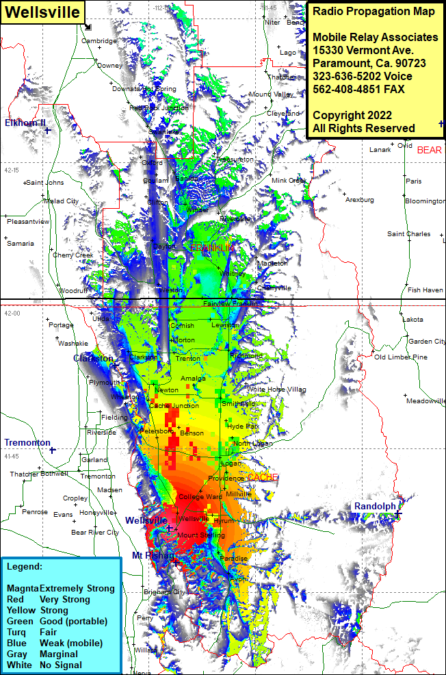 Wellsville Coverage |
| Latitude: | 041 36 41.0N | 41.6113889 |
| Longitude: | 111 57 08.6W | -111.9523889 |
| Feet | Meters | |
| Ground Elevation: | 5698.0 | 1736.8 |
| HAAT: | 521.3 | 158.9 |
| City: | Wellsville | |
| County: | Cache | |
| State: | Utah |
This is not an MRA Owned Site. For space rental contact the site owner.
Do you own or manage this site? Click Here
Would you like to add a site to the Google Earth Map?? Click Here
Site Coverage: Coverage of Mount Sterling, Paradise, Avon, Mantua, Mount Sterling, Wellsville, Hyrum, Nibley, College Ward, Millville, River Heights, Logan, Greenville, North Logan, Hyde Park, Cardon, Petersboro, Ballard Junction Benson, Cache Junction Newton, Clarkston, Trenton, Morton, Richmond, Cove, Smithfield, White Horse Village, Amalga, Clarkston, Cornish, Lewiston, Franklin, Fairview, Anderson, Washakie, Cherryville, Mapleton, Whitney, Weston, Dayton, Riverdale, Winder, Coulam, Banida, Treasureton, Oxford