Asotin
| Site Name: | Asotin | 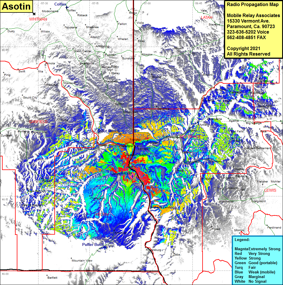 Asotin Coverage |
| Latitude: | 046 18 59.0N | 46.3163889 |
| Longitude: | 117 02 25.2W | -117.0403333 |
| Feet | Meters | |
| Ground Elevation: | 1843.0 | 561.7 |
| HAAT: | 121.6 | 37.0 |
| City: | Asotin | |
| County: | Asotin | |
| State: | Washington |
This is not an MRA Owned Site. For space rental contact the site owner.
Do you own or manage this site? Click Here
Would you like to add a site to the Google Earth Map?? Click Here
Site Coverage: Coverage of Asotin, Lewiston, Clarkson Heights, North Lewiston, Transfer, Clarkston, Moses, Uniontown, Colton, Genesee, Spalding, Lapwai, Sweetwater, Culdesac, Webb, Winchester, Craigmont, Reubens, Kippen, Chelsey, Anatone, Cloverland, Jerry, Peola, Rose Springs, Stentz Springs, Kirby, Mayview, Colton, Chambers, Staley, Busby, Union Center, Blaine, German Settlement, Gofford, 7 Post Falls