Baw Faw
| Site Name: | Baw Faw | 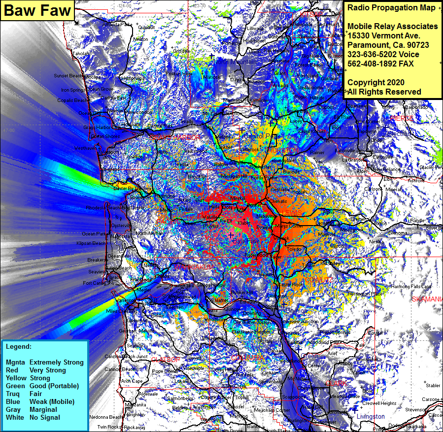 Baw Faw Coverage |
| Latitude: | 046 29 16.5N | 46.4879167 |
| Longitude: | 123 12 54.9W | -123.2152500 |
| Feet | Meters | |
| Ground Elevation: | 3113.0 | 948.8 |
| HAAT: | 2066.4 | 629.8 |
| City: | McCormick | |
| County: | Lewis | |
| State: | Washington |
This is not an MRA Owned Site. For space rental contact the site owner.
Do you own or manage this site? Click Here
Would you like to add a site to the Google Earth Map?? Click Here
Site Coverage: Coverage of McCormick, Chehalls, Evaline, Toledo, Cowlitz, Onalaska, Bremer, Riffe, Kid Valley, Saint Helens, Kelso, Longview, Bunker Hill, Oak View, Swensen, Fern Hill, Hammond, Stringtown, Naselle, Nemah, Dexter By The Sea, South Bend, Westport, Cedarville, Lankner, Flong, Siginaw, Elma, Fuller, Montesano, East Aberdeen, Garden City, Hillgrove, Sine, Delphi, Littlerock, Mima, Gate, Sunnydale, Bucoda, Tono, Vail, Ranier, Marys Corner