Bebe Mtn
| Site Name: | Bebe Mtn | 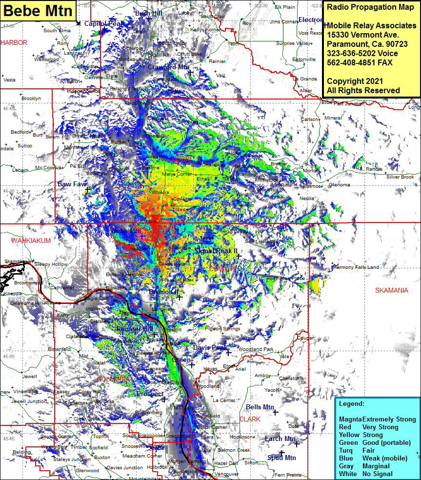 Bebe Mtn Coverage |
| Latitude: | 046 20 48.4N | 46.3467778 |
| Longitude: | 122 58 28.3W | -122.9745278 |
| Feet | Meters | |
| Ground Elevation: | 1253.0 | 381.9 |
| HAAT: | 697.8 | 212.7 |
| City: | Olequa | |
| County: | Cowlitz | |
| State: | Washington |
This is not an MRA Owned Site. For space rental contact the site owner.
Do you own or manage this site? Click Here
Would you like to add a site to the Google Earth Map?? Click Here
Site Coverage: Coverage of Ryderwood, Vader, Olequa, Winlock, Evaline, Saint Urban, Napavine, Boistfort, Klaber, Curtis, Ceres, Bunker, Adna, Littell, Claquato, Chehalis, Centralia, Fords Prairie, Galvin, Michigan Hill, Grand Mound, Tono, Nulls Crossing, Napvile, Marys Corner, Winlock, Cowlitz, Toledo, Onalaska, Lacamas, Alpha, Cinebar, Harmony, Mossyrock, Salkum Mayfield, Swofford, RIffe, WIlson, Kids Valley, Toutle, Sightly, Silverlake, Castle Rock, Headquarters, Herrington Place, Pleasant Hill, Lexington, Eufaula, Eufaula Heights, Kelso, Longview, Longview Jct, Lindbergh, Prescott, Goble, Kalama, Beaver Springs, Apiary, Deer Island, Waterview, Columbia City, Caples Landing, Saint Helens, West Saint Helens, McNulty, Warren, Ridgefield, Woodland, Clatskanie Heights, Alston, Delena, Clatskanie, Downing, Quincy, Locoda, Mayger, Inglis, Eagle Cliff, Oak Point, Bunker Hill, Woodson, Bradwood