Brynion
| Site Name: | Brynion | 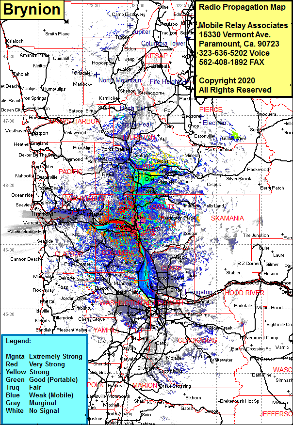 Brynion Coverage |
| Latitude: | 046 10 00.2N | 46.1667222 |
| Longitude: | 122 51 20.3W | -122.8556389 |
| Feet | Meters | |
| Ground Elevation: | 1262.0 | 384.7 |
| HAAT: | 819.7 | 249.8 |
| City: | Kelso | |
| County: | Cowlitz | |
| State: | Washington |
This is not an MRA Owned Site. For space rental contact the site owner.
Do you own or manage this site? Click Here
Would you like to add a site to the Google Earth Map?? Click Here
Site Coverage: Coverage of Kelso, Longview, Lexington, Pleasant Hill, Castle Rock, Silverlake, Vader, Winlock, Evaline, Mapavine, Marys Corner, Onalaska, Salkum, Kid Valley, Herrington Place, Saint Helens, McNutty, Ridgefield, LaCenter Hayes, Scappoose, Knapp Landing, Westport, Columbia Hieghts, Wauna, Skamokawa, Brookfield, Eden, Knappa Jct, Svensen, Biddle