Bush Hill
| Site Name: | Bush Hill | 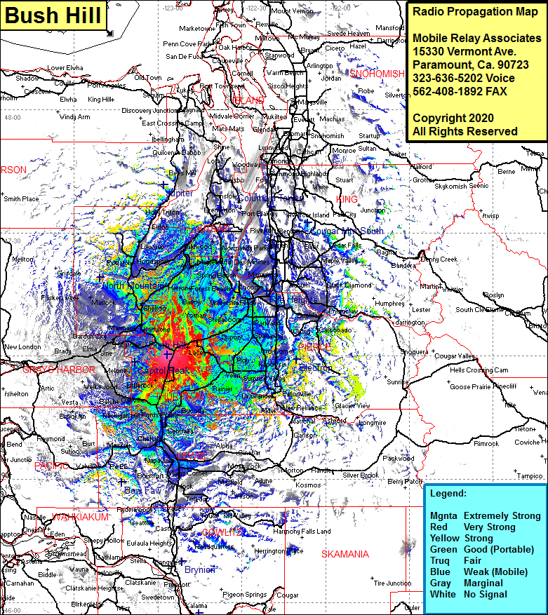 Bush Hill Coverage |
| Latitude: | 047 00 20.7N | 47.0057500 |
| Longitude: | 122 56 40.0W | -122.9444444 |
| Feet | Meters | |
| Ground Elevation: | 502.0 | 153.0 |
| HAAT: | 332.9 | 101.5 |
| City: | Tumwater | |
| County: | Thurston | |
| State: | Washington |
This is not an MRA Owned Site. For space rental contact the site owner.
Do you own or manage this site? Click Here
Would you like to add a site to the Google Earth Map?? Click Here
Site Coverage: Coverage of Turnwater, Olympia, Kellys Korner, Lacey, Thompson Place, Boston Harbor, Arcadia, Bayshore, Oakland, Marmac, Kamilche, Shelton, Agate, Arcadia, Dayton, Matlock, Deckerville, Potlatch, Little Hiquiam, Grapeview, Fair Harbor, Allyn, Sunbeach, Belfair, Sunnyslope, Bremerton Jct, Port Orchard, Southworth, Banner, Fragaria, Shawnee, South Tocoma, Monta Vista, Parkland, Spanway, Loveland, Rocky Ridge, Tanwax, Surprise Valley, La Grande