Chelan Butte
| Site Name: | Chelan Butte | 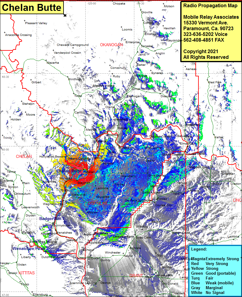 Chelan Butte Coverage |
| Latitude: | 047 48 25.5N | 47.8070833 |
| Longitude: | 120 02 04.6W | -120.0346111 |
| Feet | Meters | |
| Ground Elevation: | 3832.0 | 1168.0 |
| HAAT: | 1862.8 | 567.8 |
| City: | Chelan | |
| County: | Chelan | |
| State: | Washington |
This is not an MRA Owned Site. For space rental contact the site owner.
Do you own or manage this site? Click Here
Would you like to add a site to the Google Earth Map?? Click Here
Site Coverage: Coverage of Chelan, Chelan Falls, Stayman, Winesap, Entiat, Orondo, Wagnersburg, Waterville, Alstown, Supplee, Lamoine, Touhey, Mansfield, Howard, Azwell, Dyer, Starr, Pateros, Brewster, Methow, Niles Corner, Osborne Corner, Leahy, Sims Corner, Mold, Saint Andrews, Dry Falls Jct, Fordair, Hartline, Coulee City, Bacon, Stratford, Soap Lake, Lakeview Park, WIlson Creek, Gloyd, Mitchell, Moses Lake, Mae, Ruff, McDonald, Bassett Jct, George, Low Gap, Quincy, Winchester, Naylor, Ephrata, Trinidad, Olds