Grayback Mtn
| Site Name: | Grayback Mtn | 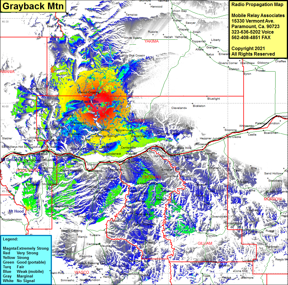 Grayback Mtn Coverage |
| Latitude: | 045 59 27.1N | 45.9908611 |
| Longitude: | 121 05 02.3W | -121.0839722 |
| Feet | Meters | |
| Ground Elevation: | 3754.0 | 1144.2 |
| HAAT: | 1436.1 | 437.7 |
| City: | Laurel | |
| County: | Klickitat | |
| State: | Washington |
This is not an MRA Owned Site. For space rental contact the site owner.
Do you own or manage this site? Click Here
Would you like to add a site to the Google Earth Map?? Click Here
Site Coverage: Coverage of Parrott Crossing, Laurel, Panakanic, Snowden, Gilmer, B Z Corner, Guler, Glenwood, Tire Junction, Pitt, Wahkiacus, Woodruff Mill, Swale, Warnick, Gooseneck, Centerville, Blockhouse, Goldendale, Pleasant Valley, Willy Dick Crossing, Berry Patch, Biggs Junction, Rufus, Quinton, Goff, Towal, Goodnoe, Goodnoe Hills, Arlington, Shutler, Barnett, Mikkalo, Olex, Clern, Wilcox, Kent, Rosebush, Rutledge, Grass Valley, Erskine, Moro, De Moss Springs, Harmony, Fairview, McDonald, Webfoot, Emigrant Springs, Thornberry, Fairbanks, Emerson, Rice, Ednersby, Dufur, Friend, Eightmile Crossing, Parkdale, Bloucher, Oak Grove, Sonny, Mosier, White Salmon, Husum, Lenz