Green
| Site Name: | Green | 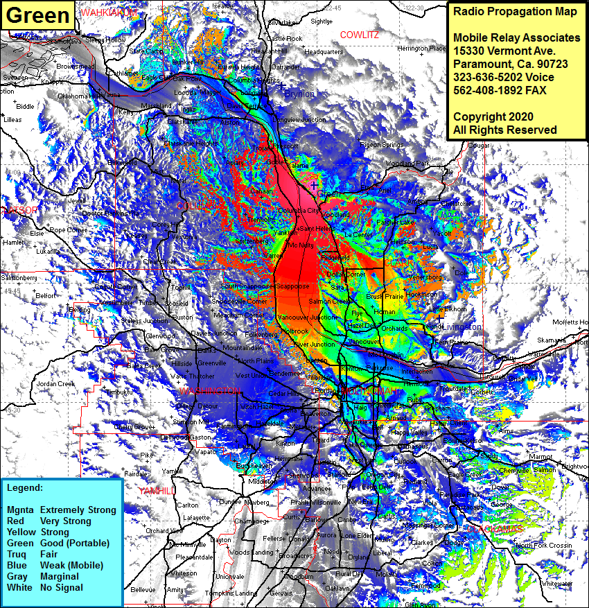 Green Coverage |
| Latitude: | 045 57 24.8N | 45.9568889 |
| Longitude: | 122 45 25.6W | -122.7571111 |
| Feet | Meters | |
| Ground Elevation: | 1108.0 | 337.7 |
| HAAT: | 737.6 | 224.8 |
| City: | Woodland | |
| County: | Cowlitz | |
| State: | Washington |
This is not an MRA Owned Site. For space rental contact the site owner.
Do you own or manage this site? Click Here
Would you like to add a site to the Google Earth Map?? Click Here
Site Coverage: Coverage of Kalama, Woodland, La Center, Cherry Grove, Meadow Glade, Hazel Dell, Blurock Landing, Scappoose, Splitzenberg, Yankon McNulty, Columbia City, Canaan, Clatskanie, Alston, Mayger, Longview, Bunker Hill, Lexington, Longview Jct, Woodland Park, Yale, Amboy, Chetatchie, Yacolt, Lucia, Dole, Scotton Corner, Brush Prairie, Orchards, Vancouver, Parkrose, Fisher, Garnas, Bridal Veil, Prindle, Bethany, North Plains, Banks, Thatcher, Mountaindale, Balm Grove, Alohan Sylvan, Beaverton, Bradley Corner, Tigard, Lake Oswego, West Linn, Oregon City, Logan, Viola, Estacada, Bissell, Douglass Ridge, Sandy, Fernwood, Glen Avon, Motilla, Canby, Massinger Corner, Macksburg and more