Larch Mtn
| Site Name: | Larch Mtn |  Larch Mtn Coverage |
| Latitude: | 045 43 01.1N | 45.7169722 |
| Longitude: | 122 17 44.8W | -122.2957778 |
| Feet | Meters | |
| Ground Elevation: | 3475.0 | 1059.2 |
| HAAT: | 2050.6 | 625.0 |
| City: | Cresswell Heights | |
| County: | Clark | |
| State: | Washington |
This is not an MRA Owned Site. For space rental contact the site owner.
Do you own or manage this site? Click Here
Would you like to add a site to the Google Earth Map?? Click Here
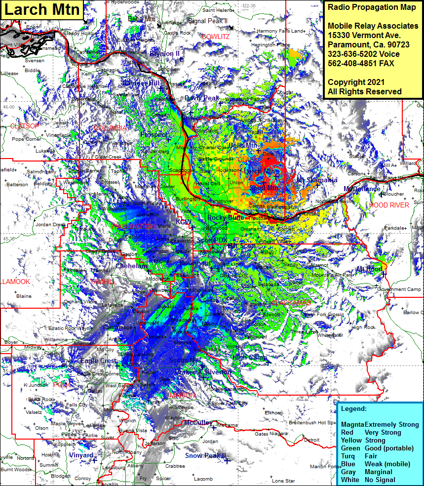
Site Coverage: Coverage of Ireland, Multnomah Falls, Oneonta, Home Valley, Sonny, Cottrell, Aims, Marmot, Alder Creek, Cherryville, Firwood, Sandy, Kelso, Douglass Ridge, Dover, George, Bissell, Garfield, Tracy, Dodge, North Fork Crossing, George, Estacada, Paradise Park, Eagle Creek, Barton, Carver, Redland, Viola, Massinger Corner, Clarkes, Colton, Fernwood, Molalla, Rural Dell, Dryland, Union Mills, Oaklawn, Marquam, Mount Angel, Gervais, Woodburn, Broadacres, Donald, Fellers, Barlow, Curtis, Champoeg, Newberg, Dundee, Springbrook, Carlton, Lafayette, Dayton, Pleasantdale, Unionvale, Tompkins Landing, Crest, Bola Village, Yamhill, Wapato, Gaston, Middleton, Chehalem, Curtis, Sherwood, Wilsonville, New Era, Canby, Lone Elder, New Era, Pulp, Sunset, Oregon City, Redland, Carver, Barton, Wilson Corner, Haley, Orient, Lake Oswego, Tigard, Durham, Herrmah, Beaverton, Kinton, Hazeldale, Laurel, Kinton, Springbrook, Newberg, Farmington, Hazeldale, Witch Hazel, Detour, Thatcher, West Union, North Plains, Greenville, Banks, Mounaindale, Davies Junction, Meacham Corner, Snooseville Corner, Buxton, Scappoose, Burlingon, Miller, Saint Johns, McLauthlin, Vancouver, Fern Prairie, Orchards, Salmon Creek, Felida, Sara, Dollar Corner, Hockinson, Vernersborg, Dole, Yacolt, Fargher Lake, Amboy, Chelatchie, Yale, Cougar, Woodland Park, Ariel, Etna, Hayes, Warren, Spitzenberg, McNulty, Saint Helens, Columbia City, Deer Island, Canaan, Apiary, Swedetown, Kalama, Pigeon Spings, Downing
