Livingston
| Site Name: | Livingston | 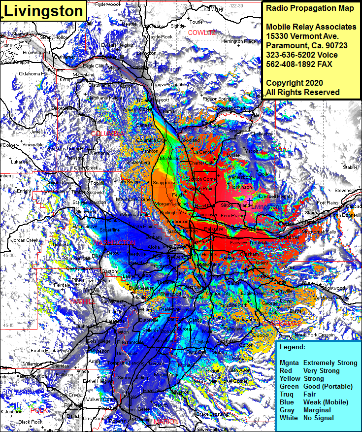 Livingston Coverage |
| Latitude: | 045 40 33.4N | 45.6759444 |
| Longitude: | 122 22 43.7W | -122.3788056 |
| Feet | Meters | |
| Ground Elevation: | 1741.0 | 530.7 |
| HAAT: | 1004.8 | 306.2 |
| City: | Camas | |
| County: | Clark | |
| State: | Washington |
This is not an MRA Owned Site. For space rental contact the site owner.
Do you own or manage this site? Click Here
Would you like to add a site to the Google Earth Map?? Click Here
Site Coverage: Coverage of Little Elkhorn, Orchards, Scappoose, Folkenberg, Linnton, Banks, Balm Grove, Detour, Laurel, Newberg, Dayton, Pleasantdale, Hopewell, Maity, Keizer, Salem, Silverton, Scotts Mills, Glen Avon, Colton, Elwood, North Fork Crossing, Mountain Air Park, Marmot, Aims, Mount Pleasant, Dodson