Mt Baldy
| Site Name: | Mt Baldy | 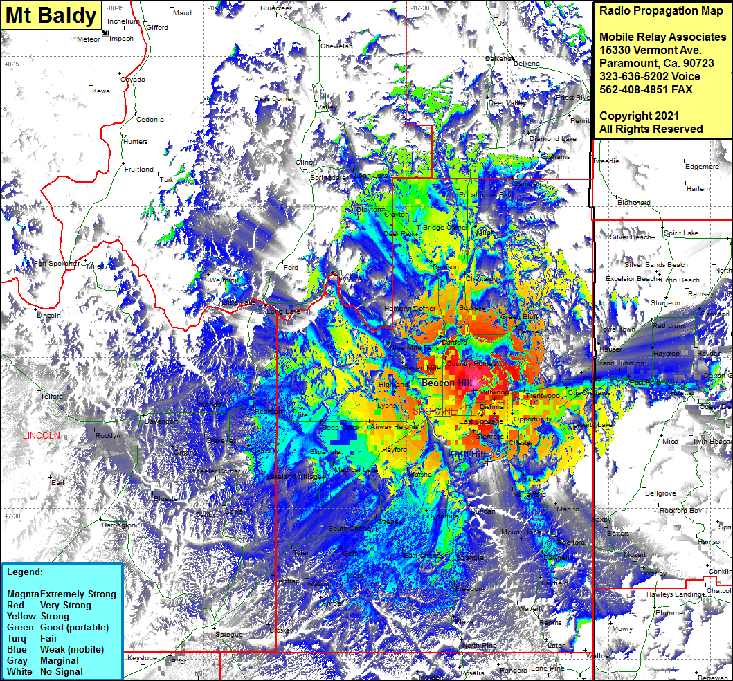 Mt Baldy Coverage |
| Latitude: | 047 42 25.7N | 47.7071389 |
| Longitude: | 117 19 51.3W | -117.3309167 |
| Feet | Meters | |
| Ground Elevation: | 2672.0 | 814.4 |
| HAAT: | 624.5 | 190.4 |
| City: | Spokane | |
| County: | Spokane | |
| State: | Washington |
This is not an MRA Owned Site. For space rental contact the site owner.
Do you own or manage this site? Click Here
Would you like to add a site to the Google Earth Map?? Click Here
Site Coverage: Coverage of Spokane, East Spokane, Parkwater, Yardley, Glenrose, Opportunity, Liberty Lake, Otis Orchards, Moab, Post Falls, Huetter, Haycrop, Hayden, Dalton Gardens, Rockaway Beach, Opportunity, Chester, Mica, Valleyford, Manito, Saxby, Mozart, Worley, Rockford, Darknell, Mount Hope, Fairfield, Duncan, Spangle, Dynamite, East Cheney, Freedom, Plaza, Marshall, Cheney, South Cheney, Geib, Mock, Amber, Mason, Fishtrap, Tyler, Medical Lake, Hayford, Airway Heights, Deep Creek, Espanola, Lakeland Village, Elanor, Gravelles, Omans, Wheeler Corner, Canby, Edwall, Bluestem, Davenport, Rocklyn, Mondovi, Long Lake, Little Falls, Wellpinit, Turntum, Loon Lake, Clayton, Clavton, Deer Park, T Bridge Corner, Denison, Hamann Corner, Dartford, Country Homes, Lyone, Highland, Seven Mile, Nine Mile Falls, Peone, Green Bluff, Buckeye, Chattaroy, Milan, Grays Landing, Pocahontas Bay, Camden, Grahams, Diamond Lake, Deer Valley, Grays Landing, Milan, Chattaroy, Hauser, Post Falls, Huetter, Dalton Gardens, Rockaway, Hayden