Mt Herman
| Site Name: | Mt Herman | 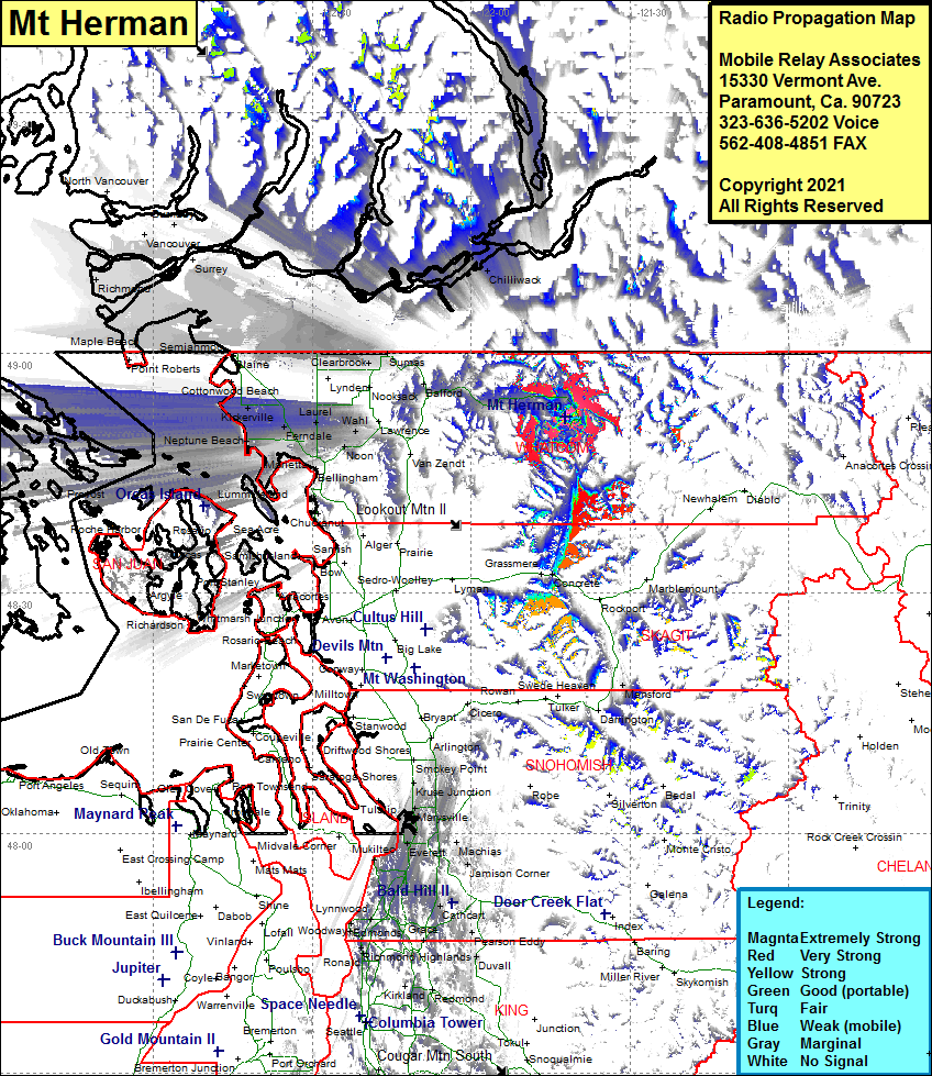 Mt Herman Coverage |
| Latitude: | 048 51 58.1N | 48.8661389 |
| Longitude: | 121 42 08.1W | -121.7022500 |
| Feet | Meters | |
| Ground Elevation: | 6027.0 | 1837.0 |
| HAAT: | -4388.2 | -1337.5 |
| City: | Warnick | |
| County: | Whatcom | |
| State: | Washington |
This is not an MRA Owned Site. For space rental contact the site owner.
Do you own or manage this site? Click Here
Would you like to add a site to the Google Earth Map?? Click Here
Site Coverage: Coverage of Mt Herman, Glacier, Maple Falls, Chilliwack, Kickerville, Mountain View, Ferndale, Laurel, Goshen, Cedarville, Brennan, Marletta, Neptune Beach, Mountain View, Lummi Island, Waldon, Prevost