Mt Washington
| Site Name: | Mt Washington | 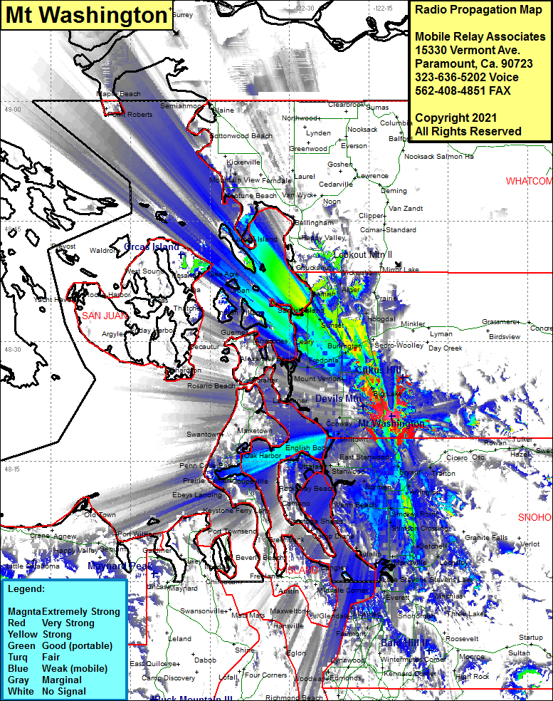 Mt Washington Coverage |
| Latitude: | 048 20 38.6N | 48.3440556 |
| Longitude: | 122 10 41.6W | -122.1782222 |
| Feet | Meters | |
| Ground Elevation: | 741.0 | 225.9 |
| HAAT: | -54.5 | -16.6 |
| City: | McMurray | |
| County: | Skagit | |
| State: | Washington |
This is not an MRA Owned Site. For space rental contact the site owner.
Do you own or manage this site? Click Here
Would you like to add a site to the Google Earth Map?? Click Here
Site Coverage: Coverage of McMurray, Bryant, Haze, Trafton, Arlington Heights, Arlington, Jordan, Riverside, Sisco Heights, Getchell, Lochsloy, Hyland, Stevens Lake, Cavalero Corner, Everett, Delta Jct, Marysville, Kruse Jct, Smokey Point, Lakewood, Norman, Stanwood, Terrys Corner, English Boom, Utsalady, Madrona Beach, Driftwood Shores, Warm Beach, McKees beach, Sunny Shores Acres, Tulalipm Mission Beach, Delta Jct, Everett, Cavalero Corner, Machias, Forest Glade, Tyee Beach, Pebble Beach, Greenbank, Penn Cove Park, Oak Harbor, Marketown, Ebeys Landing, Keystone Ferry Landing, Coupeville, Prairie Center, Coveland, San De Fuca, Swantown, Fish Town, Rexville, Skagit City, La Connor, Gibraltar, Anacortes, Guemas, Leary, Whitmarsh Jct, Whitney, Chuckanut Jct, Samish Island, Sunset, Edison Station, Blanchard, Samish, Blanchard, Alger, Burlington, Sterling, Sedro-Woolley, Hoogdal, Cokedale, Clear Lake, Baker Heights, Big Lake, Montborne