Octopus Mtn
| Site Name: | Octopus Mtn | 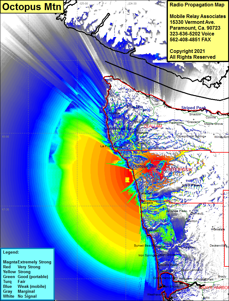 Octopus Mtn Coverage |
| Latitude: | 047 44 57.5N | 47.7493056 |
| Longitude: | 124 10 40.6W | -124.1779444 |
| Feet | Meters | |
| Ground Elevation: | 2339.0 | 712.9 |
| HAAT: | 1490.7 | 454.4 |
| City: | Oil City | |
| County: | Jefferson | |
| State: | Washington |
This is not an MRA Owned Site. For space rental contact the site owner.
Do you own or manage this site? Click Here
Would you like to add a site to the Google Earth Map?? Click Here
Site Coverage: Coverage of Oil City, Kalaloch, Clearwater, Queets, Neilton, Forks, Mora, La Push, Ozette, Iverson, Tyee, Sappho, Sekiu, Abby Island, Ruby Beach, US Highway 101 from Queets to Sappho, Taholah, Moclips, Pacific Beach, Highland Heights, Aloha, Ocean Grove, Onslow, Carlisle West, Iron Springs, Copalis Beach, Copalis Crossing, Ocean City, Sampson, Oyhut, Ocean Shores, Newton, Burrows, Gray Gables, Grays Harbor City, Westhaven, Westport, Ososta, Cohassett, Ocosta, Grayland, Heather