Puffer Butte
| Site Name: | Puffer Butte | 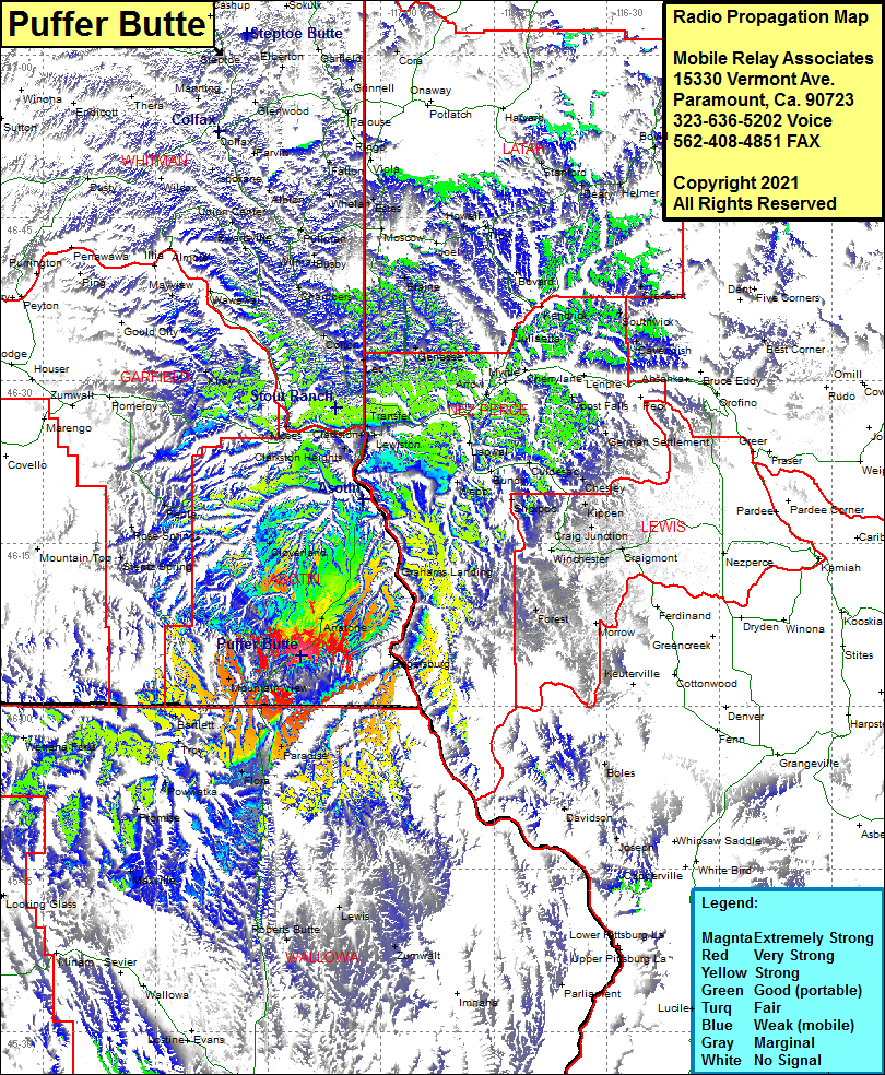 Puffer Butte Coverage |
| Latitude: | 046 04 38.4N | 46.0773333 |
| Longitude: | 117 10 39.7W | -117.1776944 |
| Feet | Meters | |
| Ground Elevation: | 4441.0 | 1353.6 |
| HAAT: | 1491.0 | 454.5 |
| City: | Anatone | |
| County: | Asotin | |
| State: | Washington |
This is not an MRA Owned Site. For space rental contact the site owner.
Do you own or manage this site? Click Here
Would you like to add a site to the Google Earth Map?? Click Here
Site Coverage: Coverage of Mountain View, Anatone, Paradise, Flora, Lewis, Maxville, Promise, Powwatka, Troy, Bartlett, Stentz Spring, Rose Springs, Mountain Top, Peola, Cloverland, Zaza, Lewiston Orchards, North Lewiston, Clarkston, Transfer, Hatwai, Forest, Uniontown, Genesee, Blaine, Arrow, Myrtle, Sweetwater