Signal Peak II
| Site Name: | Signal Peak II | 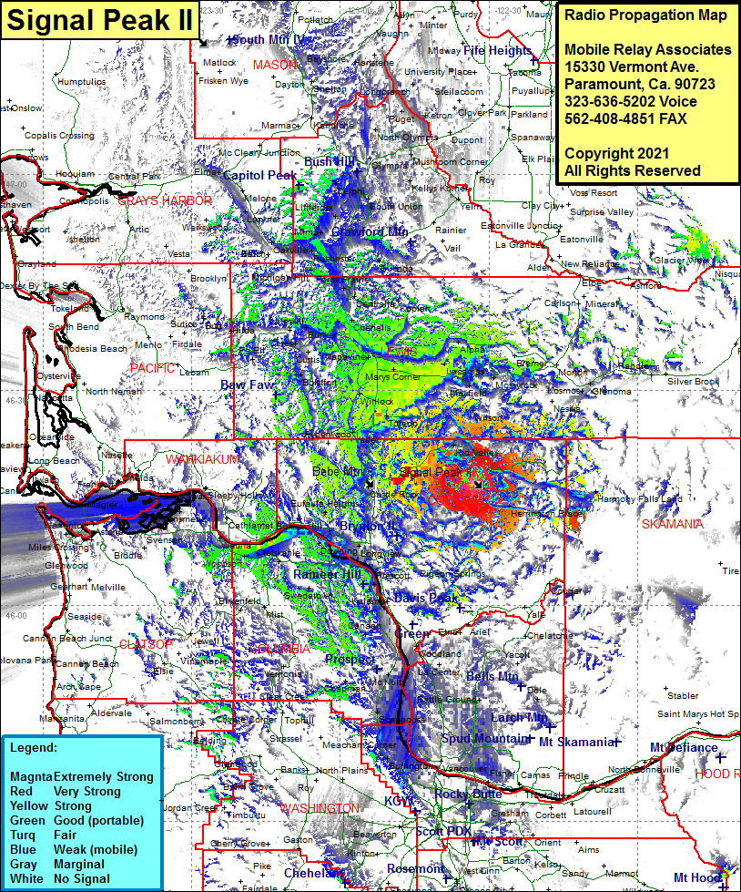 Signal Peak II Coverage |
| Latitude: | 046 17 08.1N | 46.2855833 |
| Longitude: | 122 33 06.3W | -122.5517500 |
| Feet | Meters | |
| Ground Elevation: | 3291.0 | 1003.1 |
| HAAT: | 1841.3 | 561.2 |
| City: | Saint Helens | |
| County: | Cowlitz | |
| State: | Washington |
This is not an MRA Owned Site. For space rental contact the site owner.
Do you own or manage this site? Click Here
Would you like to add a site to the Google Earth Map?? Click Here
Site Coverage: Coverage of Toutle, Kid Valley, Silverlake, Castle Rock, Pleasant Hill, Herrington Place, Pigeon Springs, Dollar Corner, Knapp Landing, Felida, Salmon Creek, Hazel Dell, Vancouver, Morgan Landing, Burlinton, Harborton, Whitwood Court, West Union, Scappoose, Clatskanie Heights, Swedetown, Canaan, Beaver Homes, Kalama, Trojan, Prescott, Longview, Bunker Hill, Oak Point, Eagle Cliff, Mayger, Inglis, Alston, Kerry, Wauma, Tongue Point Villa, Rydenwood, Vader, Toledo, Cowlitz, Winlock, Ethel, Onalaska, Evaline, Napavine, Chehalis, Littell, Bunker, Ceres, Meskill, Dryad, Centralia, Kipiah, Fords Prairie, Bucoda, Alpha, Cinegar, Bremer, Morton, Harmony, Salkum, Mossyrock, Riffe, Kosmos, Glenoma