Stout Ranch
| Site Name: | Stout Ranch | 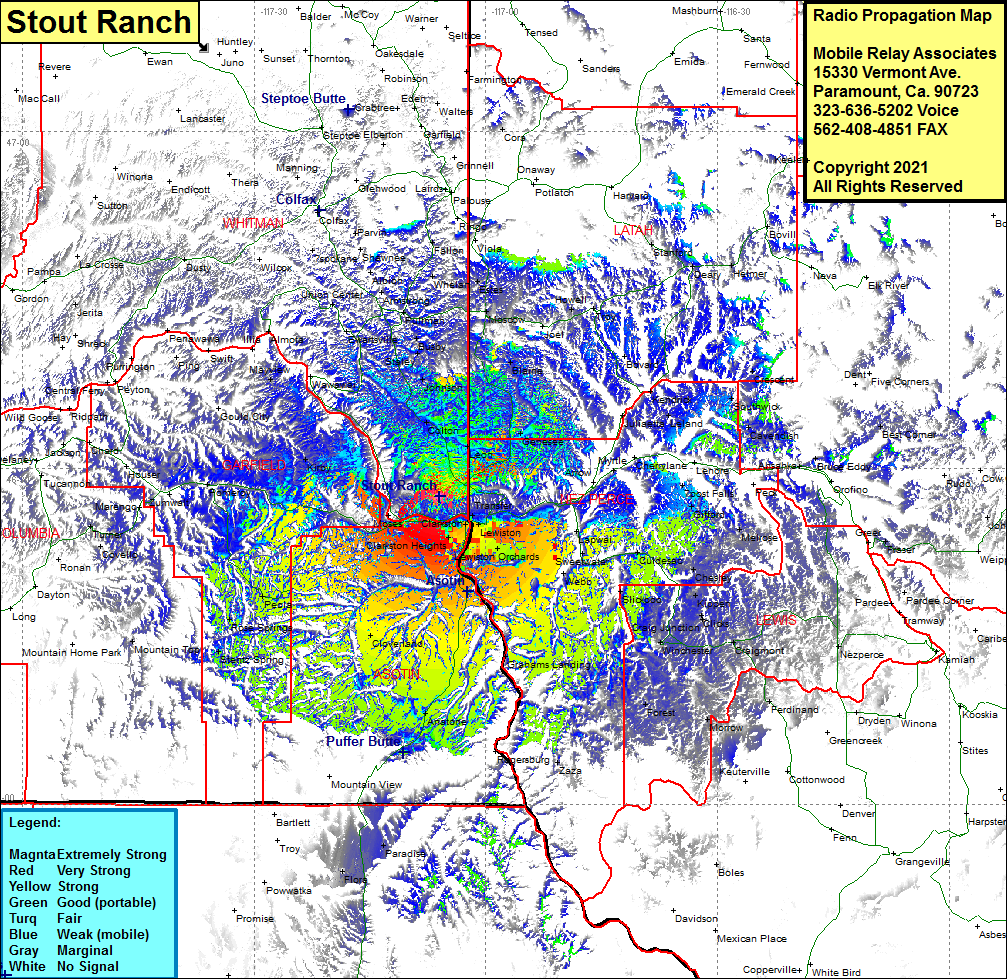 Stout Ranch Coverage |
| Latitude: | 046 27 27.1N | 46.4575278 |
| Longitude: | 117 06 03.1W | -117.1008611 |
| Feet | Meters | |
| Ground Elevation: | 2940.0 | 896.1 |
| HAAT: | 1067.9 | 325.5 |
| City: | Moses | |
| County: | Whitman | |
| State: | Washington |
This is not an MRA Owned Site. For space rental contact the site owner.
Do you own or manage this site? Click Here
Would you like to add a site to the Google Earth Map?? Click Here
Site Coverage: Coverage of Transfer, North Lapwai, Arrow, 7 Port Falls, Gifford, German Setlement, Peck, Riverside, Gifford, German Settlement, Culdesac, Webb, Lewiston Orchards, Lewiston, Slickpoo, Kippen, Reubens, Chesley, Clicks, Fletcher, Mohler, Craigmont, Winchester, Perdinand, Morrow, Forest, Cottonwood, Zaza, Grahams Landing, Anatone, Paradise, Flora, Cloverland, Clarkston, Moses, Peola, Rose Springs, Stentz Spring, Mountain Top, Pomeroy, Kirby, Gould City, Mayview, Illia, Swift, Ewartsville, Staley, Chambers, Busby, Colton, Uniontown, Union Center, Armstrong, Pullman, Sunshine, Whelan, Fallon, Estes, Moscow, Blaine, Genesee, Joel, Howell, Troy, Bovard, Kendrick, Crescent, Southwick, Cavendish, Leland