Wenatchee Peak
| Site Name: | Wenatchee Peak | 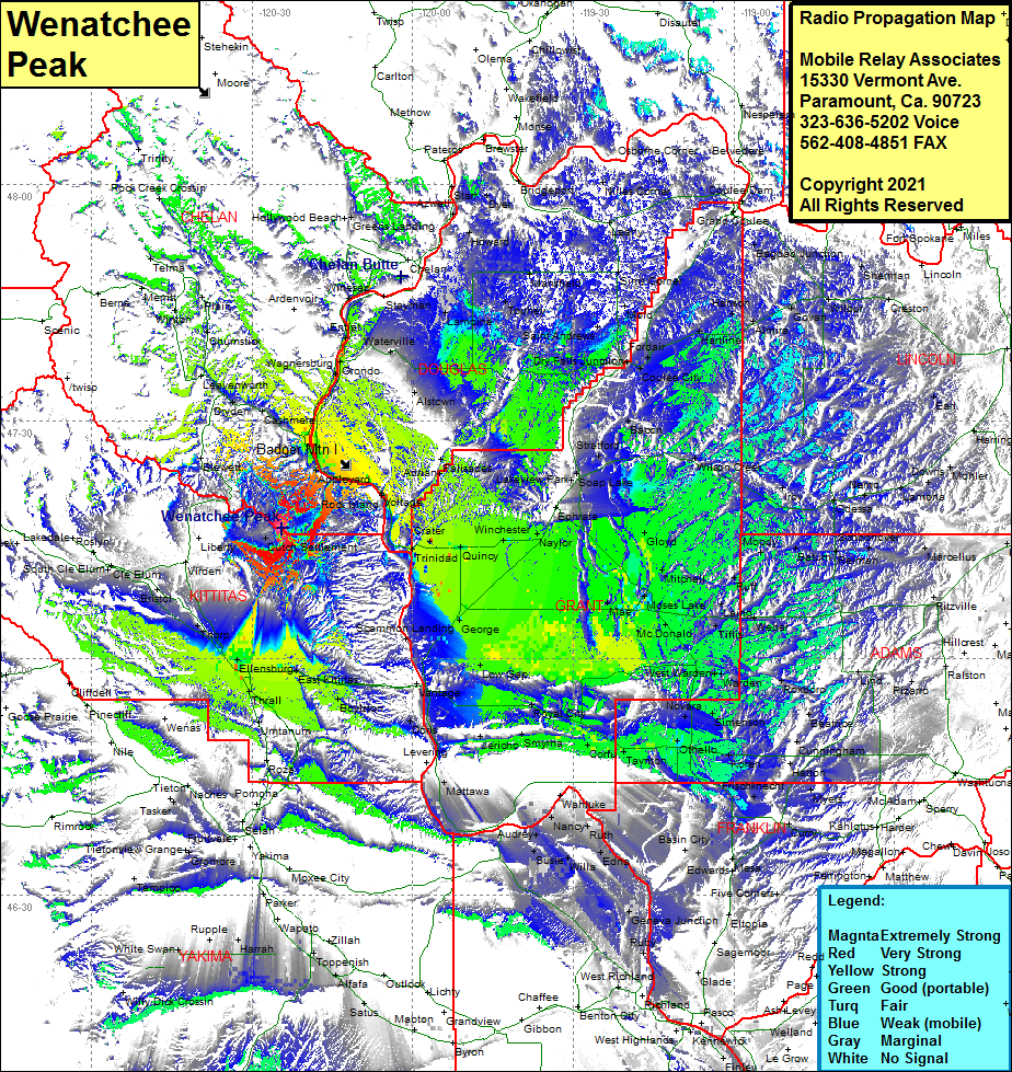 Wenatchee Peak Coverage |
| Latitude: | 047 16 26.9N | 47.2741389 |
| Longitude: | 120 24 24.1W | -120.4066944 |
| Feet | Meters | |
| Ground Elevation: | 6747.0 | 2056.5 |
| HAAT: | 2518.2 | 767.6 |
| City: | Wenatchee Heights | |
| County: | Chelan | |
| State: | Washington |
This is not an MRA Owned Site. For space rental contact the site owner.
Do you own or manage this site? Click Here
Would you like to add a site to the Google Earth Map?? Click Here
Site Coverage: Coverage of Wenatchee Heights, Telma, Winton, Telma, Leavenworth, Dryden, Cashmere, Monitor, Wehatchee, Malaga, Voltage, Bonspur, Trinidad, Crater, Quincy, Winchester, Naylor, Appledale, Adrian, Palisades, Alstown, Waterville, Orondo, Entiat, Supplee, Lamoine, Touhey, Mansfield, Azwell, Howard, Starr, Dyer, Dry Falls Jct, Mold, Sims Corner, Nilles Corner, Osbourne Corner, George, Mae, Moses Lake, Mitchell, Gloyd, Moody, Ruff, Laing, Weber, Schrag, Batum, Lauer, Tiffis, Ritell, McDonald, West Warden, Warden, Roxboro, Servia, Beatrice, Cunningham, Bruce, Simenson, Bruce, Novara, Othello, Koren, Shano, Hatton, Cunningham, Roxboro, Servia, Beatrice, Meyers, Frischnecht, Tavnton, Corfu, Smyrna, Wanapum Village, Schwana, Doris, Beverly Jct, Rye, Boylston, Renslow, Kittitas, Regal, Ellenburg, Holmes, Thrall, Edgemont, Thorp