Albin Tower II
| Site Name: | Albin Tower II | 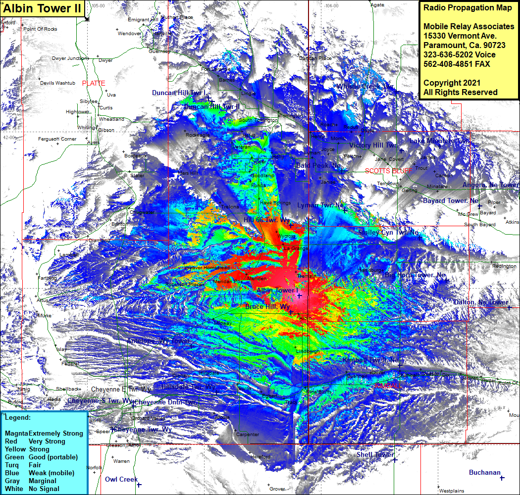 Albin Tower II Coverage |
| Latitude: | 041 28 40.4N | 41.4778889 |
| Longitude: | 104 06 01.4W | -104.1003889 |
| Feet | Meters | |
| Ground Elevation: | 5,399.0 | 1,645.6 |
| HAAT: | 422.3 | 128.7 |
| City: | Albin | |
| County: | Laramie | |
| State: | Wyoming |
This is not an MRA Owned Site. For space rental contact the site owner.
Do you own or manage this site? Click Here
Would you like to add a site to the Google Earth Map?? Click Here
Site Coverage: Coverage of Tremain, Janise, Lyman, Henry, Morill, Duncan Place, Roach, Redus, Doyle, Pelton, James, Carlson, Minatare, McGrew, Piper, Bayard, Angora, Vance, Kemp, Redington, Potter, Jacinto, Dix, Kimbell, Bushnell, Pine Bluffs, Lindbergh, Tracy, Burns, Carperter, Hereford, Burns, Arcola, Hillsdale, Midway, Meridian, Robinson Place, Weaver Homestead, La Grange, Wycross, Cheyenne, Robinson Place, Morke, Chugwater, Trelona, Hawk Springs, Fonda, Goodland, Yoder, Holly, Veteran, Mers Hill, Slater, Rockeagle, Gobson, Heldt, Cottier, South Torrington, Torrington, Fort Laramie