Big Sandy
| Site Name: | Big Sandy | 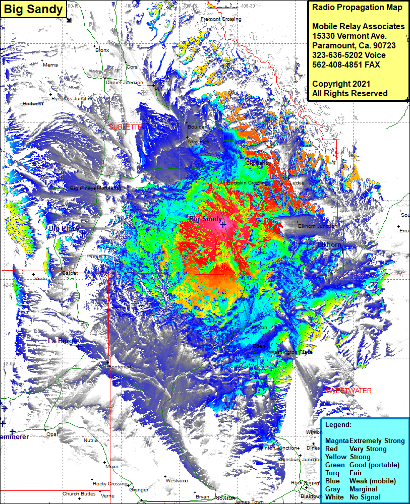 Big Sandy Coverage |
| Latitude: | 042 25 26.8N | 42.4241111 |
| Longitude: | 109 33 39.1W | -109.5608611 |
| Feet | Meters | |
| Ground Elevation: | 7,056.0 | 2,150.7 |
| HAAT: | 205.0 | 62.5 |
| City: | New Fork | |
| County: | Sublette | |
| State: | Wyoming |
This is not an MRA Owned Site. For space rental contact the site owner.
Do you own or manage this site? Click Here
Would you like to add a site to the Google Earth Map?? Click Here
Site Coverage: Coverage of the northwest portion of Sweetwater County, the southeastern portion of Sublette County, New Fork, Boulder, Pinedale, Cora, Daniel Junction, Big Sandy, Buckskin, Leckie, Elkhorn Junction, Farson, Eden, Washington Place, Fontenelle, Calpet, Big Piney, Marbleton