Bitter Creek
| Site Name: | Bitter Creek | 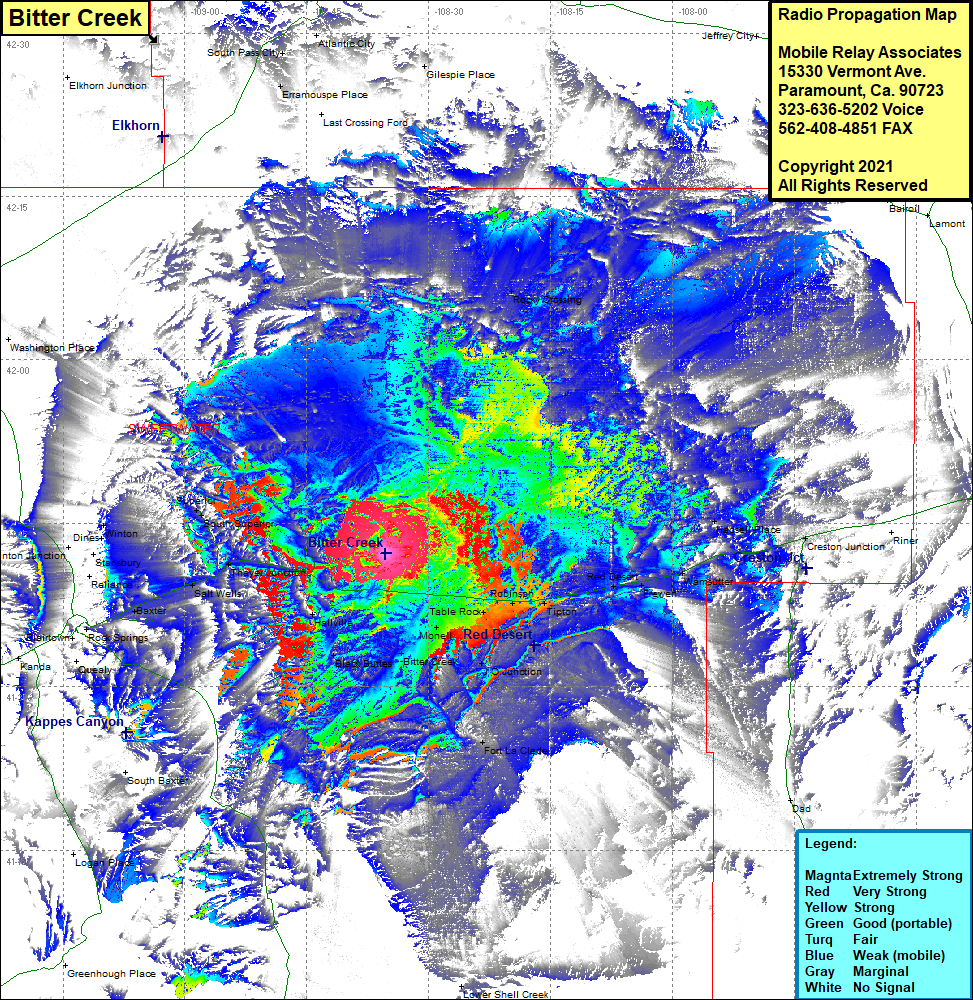 Bitter Creek Coverage |
| Latitude: | 041 42 15.4N | 41.7042778 |
| Longitude: | 108 35 20.4W | -108.5890000 |
| Feet | Meters | |
| Ground Elevation: | 7,101.0 | 2,164.4 |
| HAAT: | 343.3 | 104.6 |
| City: | Hallville | |
| County: | Sweetwater | |
| State: | Wyoming |
This is not an MRA Owned Site. For space rental contact the site owner.
Do you own or manage this site? Click Here
Would you like to add a site to the Google Earth Map?? Click Here
Site Coverage: Coverage of the northwest portion of Sweetwater County, Rocky Crossing, Table Rock, Robinson, Tipton, Red Desert, Frewen, Warmsutter, Hadsell Place, Creston Junction, J O Junction, Fort La Clede, Bitter Creek, Black Buttes, Monell, Hallville, Thayer Junction, South Superior, Superior, Salt Wells, North Baxter, Stansbury, Winton, Dines