Borie Tower
| Site Name: | Borie Tower | 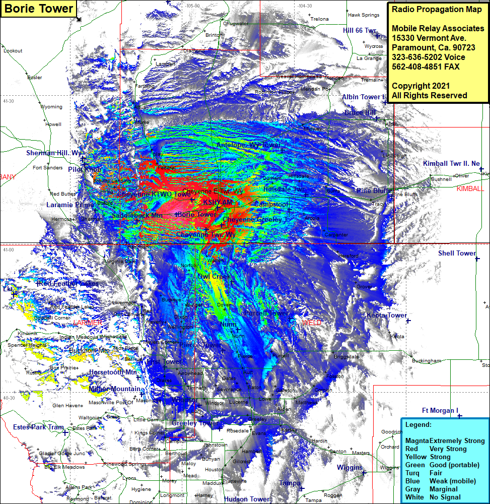 Borie Tower Coverage |
| Latitude: | 041 06 00.8N | 41.1002222 |
| Longitude: | 105 01 30.5W | -105.0251389 |
| Feet | Meters | |
| Ground Elevation: | 6,833.0 | 2,082.7 |
| HAAT: | 441.4 | 134.6 |
| City: | Borie | |
| County: | Laramie | |
| State: | Wyoming |
This is not an MRA Owned Site. For space rental contact the site owner.
Do you own or manage this site? Click Here
Would you like to add a site to the Google Earth Map?? Click Here
Site Coverage: Coverage of most of Laramie County, northwest portion of Weld County and the eastern border area of Larimer County, Buford, Hirsig, Browns Landing, Federal, Islay, Murke, Attus, Farthing, Cheyenne, Orchard Valley, Altvan, Durham, Hillsdale, Midway, Meriden, Weaver Homestead, Robinson Place, Albin, Lindbergh, Tracy, Egbert, Burns, Carpenter, Hereford, Grover, Keota, Buckingham, Briggsdale, Fosston, Cornish, Matthews, Galeton, Purcell, Alden, Lowe, Lucerne, Eaton, Greeley, Kersey, Kuner, Farmers, Windsor, Severance, Gates, Ault, Pierce, Nunn, Dover, Farmers, Windsor, Lory, Hambert, Elwell, Johnstown, Campion, Kings Corner, Drakes, Omega, Harmony, Fort Collins, Kluver, Kenyon Corner, Meyers Corner, Wellington, Dixon, Bulger, Buckeye, Waverly, Rex, Own Canyon, Livermore, Virginia Dale, Norfolk, Warren, Athon, Gleason, Harriman, Tie Siding, Hermosa