Casper Mtn I
| Site Name: | Casper Mtn I | 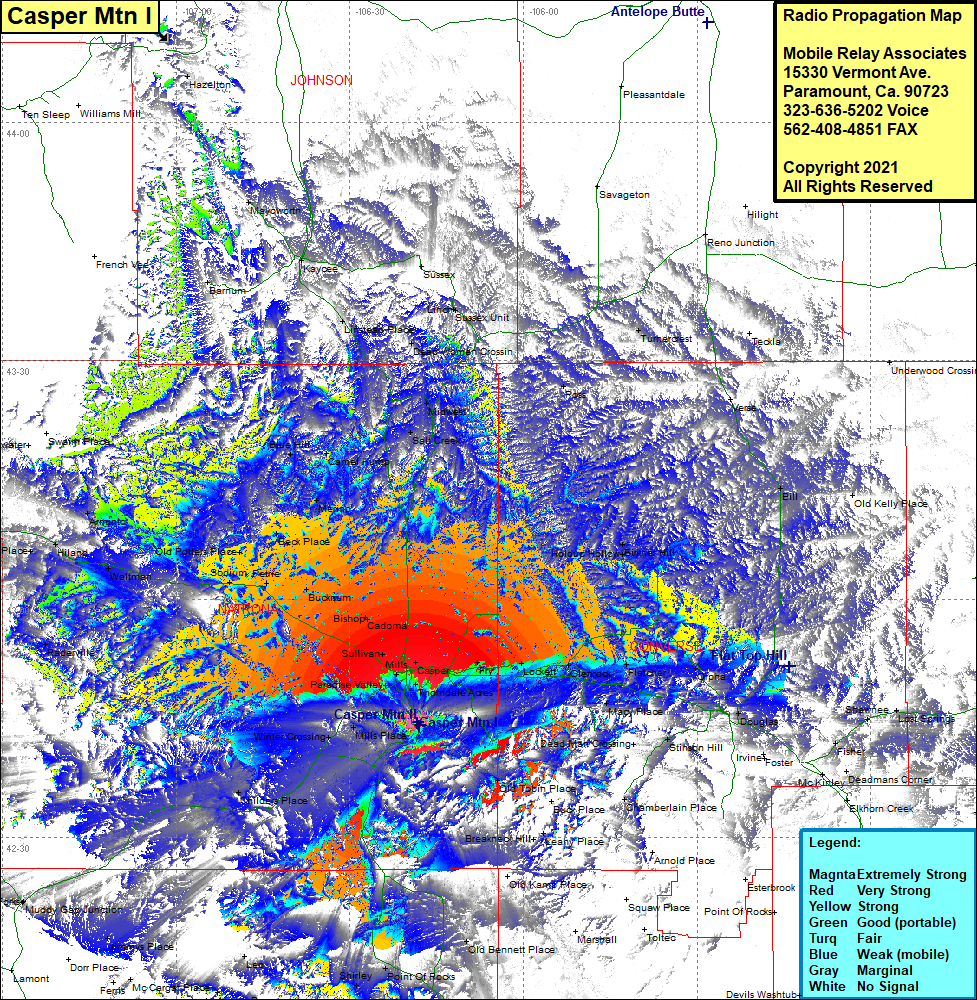 Casper Mtn I Coverage |
| Latitude: | 042 44 27.5N | 42.7409722 |
| Longitude: | 106 18 24.0W | -106.3066667 |
| Feet | Meters | |
| Ground Elevation: | 8,078.0 | 2,462.2 |
| HAAT: | 1,726.5 | 526.2 |
| City: | Eadsville | |
| County: | Natrona | |
| State: | Wyoming |
This is not an MRA Owned Site. For space rental contact the site owner.
Do you own or manage this site? Click Here
Would you like to add a site to the Google Earth Map?? Click Here
Site Coverage: Coverage of Casper. Salt Creek. Midwest. Fry. Lockett, Glenrock, Fletcher, Orpha, Holdup Hollow, Birkner Hill, Ross, Verse, Bill, Orpha, Fletcher, Macy Place, Douglas, Stinson Hill, Dead Man Crossing, Irvine, Foster, Ammon, Deadmans Corner, Fisher, Shawnee, Lost Springs, Old Tobin Place, Breakneck Hill, Leathy Place, Price Place, Winter Crossing, Childers Place, Point of Rocks, Shirley, Leo, Kortes Dam, Jimmys Place, Muddy Gap Junction, Paradise Valley, Raderville, Mills, Sullivan, Bishop, Cadona, Bucknum, Sodium, Petrie, Old Potters Place, Waltman, Beck Place, Merino, Carmel Hump, Blue Hill, Hiland, Arminto, Osborne Place, Moneta, Blue Hill, Three Forks