Cedar Cody
| Site Name: | Cedar Cody | 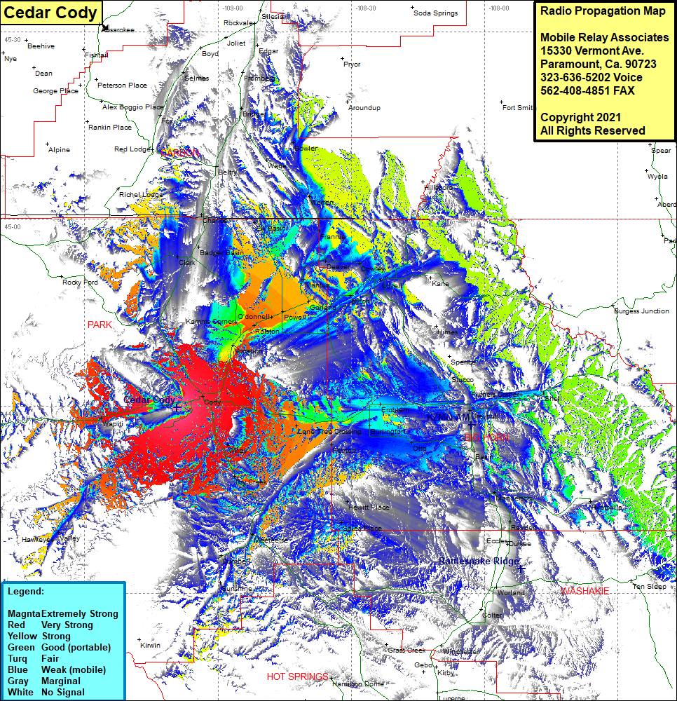 Cedar Cody Coverage |
| Latitude: | 044 29 46.5N | 44.4962500 |
| Longitude: | 109 09 14.6W | -109.1540556 |
| Feet | Meters | |
| Ground Elevation: | 7,656.0 | 2,333.5 |
| HAAT: | 1,881.5 | 573.5 |
| City: | Cody | |
| County: | Park | |
| State: | Wyoming |
This is not an MRA Owned Site. For space rental contact the site owner.
Do you own or manage this site? Click Here
Would you like to add a site to the Google Earth Map?? Click Here
Site Coverage: Coverage of the eastern portion of Park County, Wapiti, Cody, Clark, Badger Basin, Chance, Elk Basin, Belfry, Bridger, Wade, Bowler, Warren, Frannie, Vocation, O’donnell, Powell, Mantua, Deaver, Cowley, Lovell, Byron, Himes, Spence, Stucco, Reeves Corner, Shell, Greybull, Lone Tree Crossing, Fenton, Otto, Basin, Manderson, Hyattville, Rairden, Eccles, Sales Place, Hewitt Place, Wiley, Dry Creek, Meeteetse, Dumbell, Sunshine, Hawkeye Valley