Cherokee Peak
| Site Name: | Cherokee Peak | 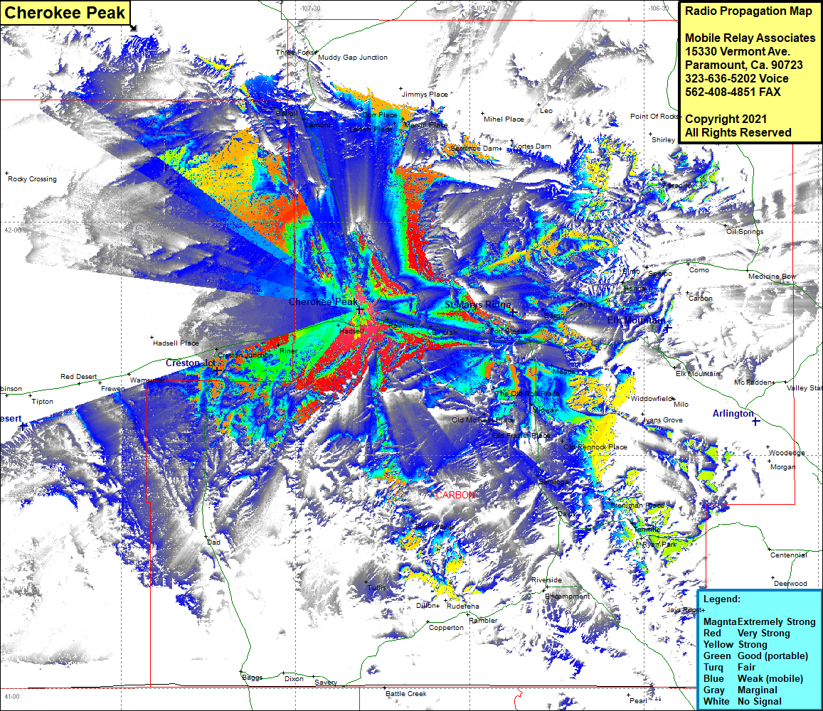 Cherokee Peak Coverage |
| Latitude: | 041 48 45.6N | 41.8126667 |
| Longitude: | 107 19 02.6W | -107.3173889 |
| Feet | Meters | |
| Ground Elevation: | 7,661.0 | 2,335.1 |
| HAAT: | 706.4 | 215.3 |
| City: | Rawlins | |
| County: | Carbon | |
| State: | Wyoming |
This is not an MRA Owned Site. For space rental contact the site owner.
Do you own or manage this site? Click Here
Would you like to add a site to the Google Earth Map?? Click Here
Site Coverage: Coverage of a major portion of Carbon County, Dorr Place, Marvin Place, Leo, Kortes Dam, Shirley, Paradise, Sampo, Elmo, Hanna, Elk Mountain, Old Brooks Place, Dana, Edson, Fort Steele, Sinclair, Rawlins, The Old Bob Place, Old Johnson Place, Old Mckeal Place, Old Haymaker Place, Saratoga, Davis, Breniman Place, Tenmile, Jays Roose, Twin Grove, Rudefena, Tullis, Hadsell, Riner, Cherokee, Lamont, Bairoil