Cheyenne KTWO
| Site Name: | Cheyenne KTWO | 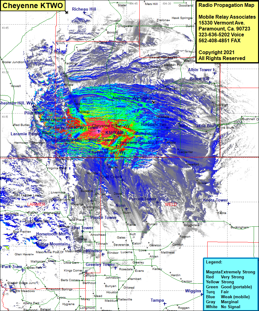 Cheyenne KTWO Coverage |
| Latitude: | 041 08 55.9N | 41.1488611 |
| Longitude: | 104 57 24.5W | -104.9568056 |
| Feet | Meters | |
| Ground Elevation: | 6,459.0 | 1,968.7 |
| HAAT: | 125.9 | 38.4 |
| City: | Cheyenne | |
| County: | Laramie | |
| State: | Wyoming |
This is not an MRA Owned Site. For space rental contact the site owner.
Do you own or manage this site? Click Here
Would you like to add a site to the Google Earth Map?? Click Here
Site Coverage: Coverage of the southern portion of Laramie County, Cheyenne, Archer, Durham, Altvan, Wilkinson Place, Weaver Homestead, Robinson Place, Midway, Meriden, Albin, Lindbergh, Robert, Tracy, Egbert, Burns, Arcola, Carpenter, Hillsdale, Hereford, Grover, Athol, Gleason, Orchard Valley, Warren, Rockport, Norfolk, Dover, Nunn, Pierce, Stage, Ault, Purcell, Bulger, Dixon, Wellington, Waverly, Buckeye, Harriman, Buford, Vedauwoo Glen, Hirsig, Shellback, Browns Landing, Federal, Islay, Altos