Copper Mtn III
| Site Name: | Copper Mtn III | 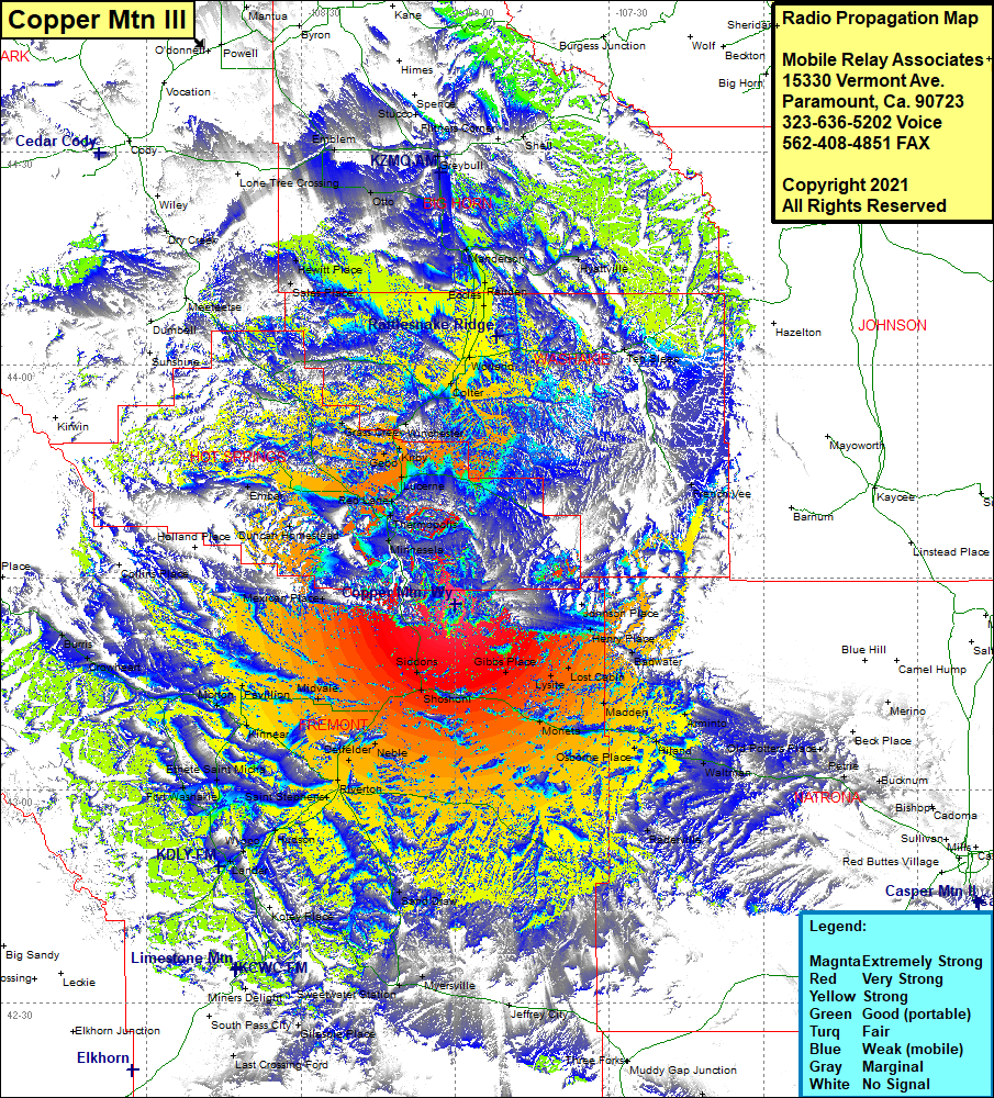 Copper Mtn III Coverage |
| Latitude: | 043 26 15.0N | 43.4375000 |
| Longitude: | 107 59 57.2W | -107.9992222 |
| Feet | Meters | |
| Ground Elevation: | 8,198.0 | 2,498.8 |
| HAAT: | 1,964.0 | 598.6 |
| City: | Shoshoni | |
| County: | Fremont | |
| State: | Wyoming |
This is not an MRA Owned Site. For space rental contact the site owner.
Do you own or manage this site? Click Here
Would you like to add a site to the Google Earth Map?? Click Here
Site Coverage: Coverage of Colter, Worland, Eccles, Rairden, Manderston, Basin, Hyattville, Shell, Reeves Corner, Stucco, Emblem, Otto, Ten Sleep, Williams Mill, French Vee, Winchester, Kirby, Gebo, Grass Creek, Lucerne, Red Lane, Thermopolis, Minnesela, Nichelson Place, Johnson Place, Henry Place, Swaim Place, Backwater, Madden, Armito, Hiland, Waltman, Osborne Place, Raderville, Old Potters Place, Sodium, Moneta, Lost Cabin, Gibbs Place, Shoshoni, Siddons, Bonneville, Boysen, Dormick, Neble, Midvale, Pavillion, Morton, Kinnear, Riverton, San Draw, Kotey Place, Lander, Wyopo, Hudson, Saint Stephens, Arapahoe, Hudson, Wind River, Lander, Milford, Ethete Saint Micha, Fort Washakie, Crowheart, Burris, Mexican Place, Duncan Homestead, Embar, Sunshine, Bumbell, Meeteetse, Sales Place, Hewitt Place, Dry Creek, Lone Tree Crossing, Fenton