Duncan Hill Twr II
| Site Name: | Duncan Hill Twr II | 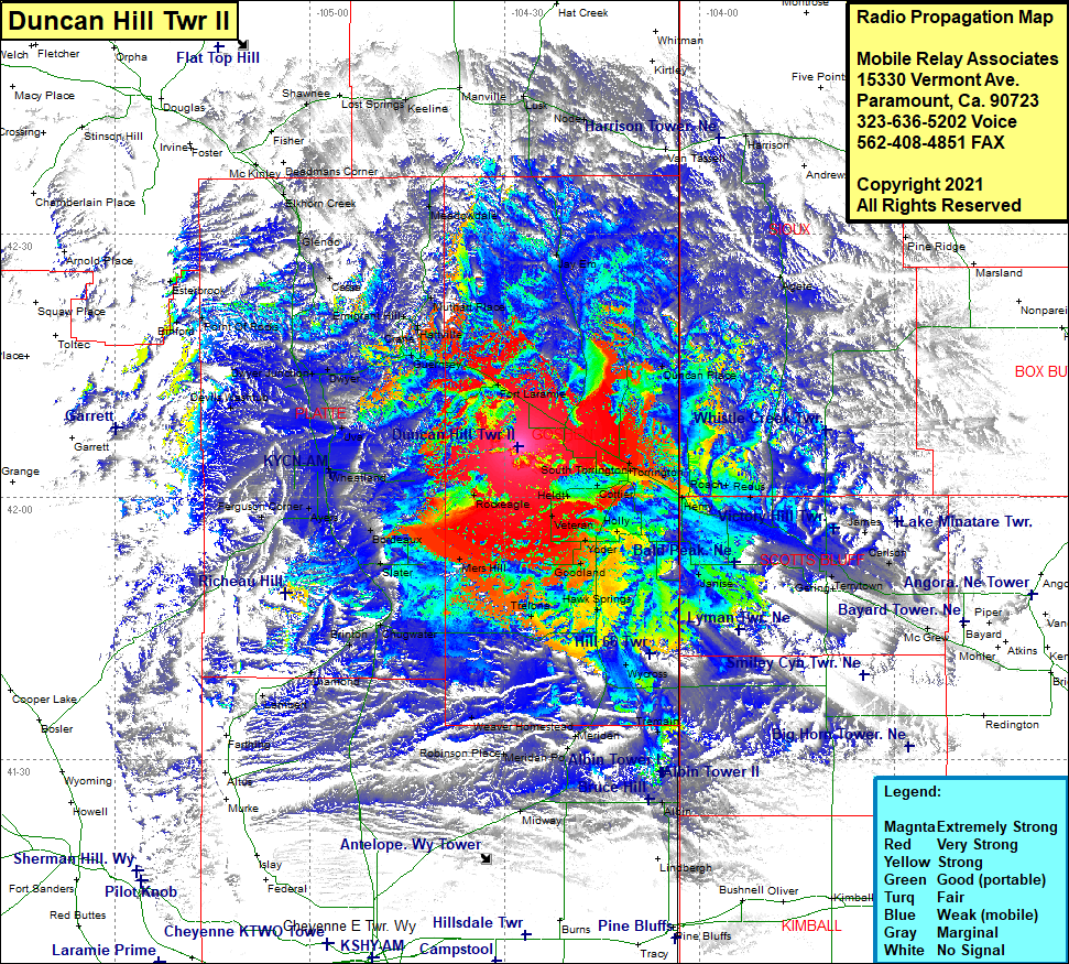 Duncan Hill Twr II Coverage |
| Latitude: | 042 05 46.2N | 42.0961667 |
| Longitude: | 104 27 55.8W | -104.4655000 |
| Feet | Meters | |
| Ground Elevation: | 4822.0 | 1469.7 |
| HAAT: | 537.5 | 163.8 |
| City: | Lingle | |
| County: | Goshen | |
| State: | Wyoming |
This is not an MRA Owned Site. For space rental contact the site owner.
Do you own or manage this site? Click Here
Would you like to add a site to the Google Earth Map?? Click Here
Site Coverage: Coverage of Barnes, Lingle, Fort Laramie, Guernsey, Hartville, Wendover, Emigrant Hill, Muthart Place, Meadowdale, Keeline, Manville, Lusk, Jay Em, Node, Harrison, Agate, South Torrington, Torrington, Cottier, Henry, Roach, Redus, Doyle, Morrill, Joyce, Jane, Covert, James, Carlson, Minatare, Melbeta, McGrew, South Bayard, Piper, Heldt, Veteran, Holly, Lyman, Yoder, Goodland, Fonda, Hawk Springs, Duroc, Wycross, Janise, LaGrange, Tremain, Meriden, Weaver Homestead, Robinson Place, Midway, Alban, Lambert, Diamond, Brinton, Chugwater, Mers Hill, Slater, Bordeaux, Rockeagle, Ayers, Ferguson Corner, Whiting, Gibson, Wheatland, Curtis, Uva, Devisl Washtub, Dwyer Junction, Dwyer, Emigrant Hill, Muthart Place, Cassa, Glendo, Bana