Flat Top Hill
| Site Name: | Flat Top Hill | 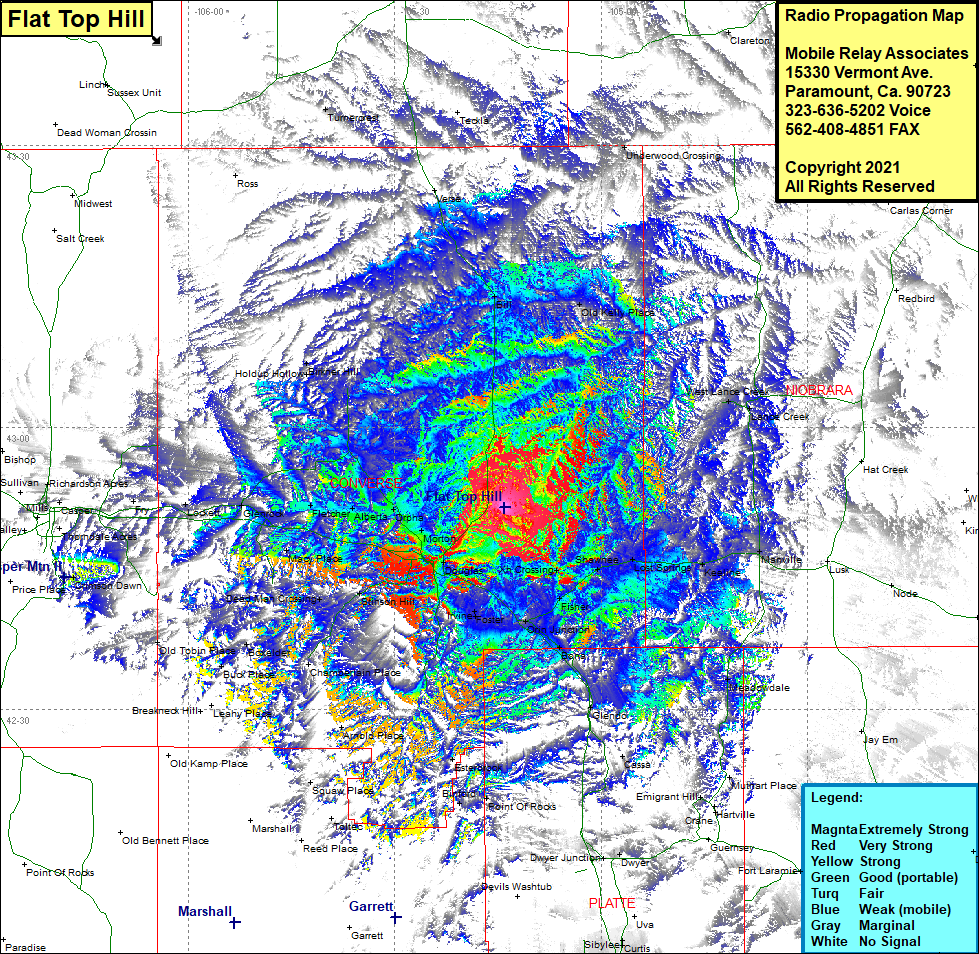 Flat Top Hill Coverage |
| Latitude: | 042 51 29.0N | 42.8580556 |
| Longitude: | 105 14 05.3W | -105.2348056 |
| Feet | Meters | |
| Ground Elevation: | 5,365.0 | 1,635.3 |
| HAAT: | 354.4 | 108.0 |
| City: | Douglas | |
| County: | Converse | |
| State: | Wyoming |
This is not an MRA Owned Site. For space rental contact the site owner.
Do you own or manage this site? Click Here
Would you like to add a site to the Google Earth Map?? Click Here
Site Coverage: Coverage of Bill, Old Kelly Place, West Lance Creek, Lance Creek, Manville, Keeline, Lost Springs, Shawnee, Xh Crossing, Fisher, Orin Junction, Bona, Elkhorn Creek, Meadowdale, Glendo, Cassa, Muthart Place, Emigrant Hill, Dwyer, Dwyer Junction, Point of Rocks, Binford, Esterbrook, Foster, Irvine, Douglas, Stinson Hill, Dead Man Crossing, Chamberlain Place, Arnold Place, Squaw Place, Boxelder, Old Tobin Place, Buck Place, Macy Place, Morton, Orpha, Alberta, Fletcher, Glenrock, Lockett, Fry, Holdup Hollow, Birkner Hill, Whipple Hollow, Tumercrest