Garrett
| Site Name: | Garrett | 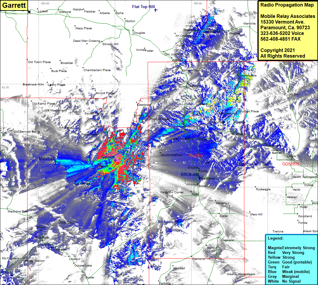 Garrett Coverage |
| Latitude: | 042 07 53.5N | 42.1315278 |
| Longitude: | 105 29 50.3W | -105.4973056 |
| Feet | Meters | |
| Ground Elevation: | 7,428.0 | 2,264.1 |
| HAAT: | 338.5 | 103.2 |
| City: | Garrett | |
| County: | Albany | |
| State: | Wyoming |
This is not an MRA Owned Site. For space rental contact the site owner.
Do you own or manage this site? Click Here
Would you like to add a site to the Google Earth Map?? Click Here
Site Coverage: Coverage of Binford, Point of Rocks, Cassa, Fisher, Xh Crossing, Shawnee, Lost Springs, Keeline, Meadowville, Bona, Elkhorn Creek, Glendo, Muthart Place, Emigrant Hill, Hartville, Wendover, Guernsey, Dwyer, Dwyer Junction, Devils Washtub, Uva, Curtis, Sibylee, Wheatland, Whiting, Givson, Ayers, Ferguson Corner, Bordeaux, Brinton, Garrett, La Grange, Rock Creek, Bosler, Cooper Lake, Harper, Rock River, WIlcox, Oil Springs, Old Kamp Place, Little Medicine, Marshall, Reed Place, Toltec, Squaw Place