Harper
| Site Name: | Harper | 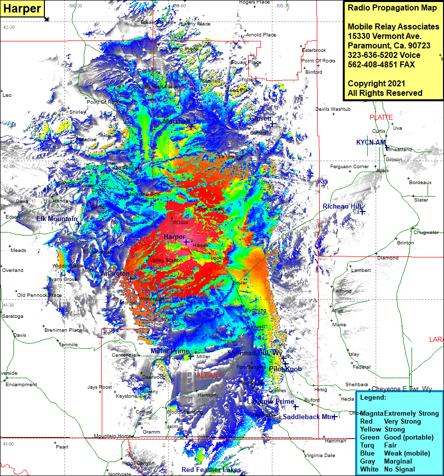 Harper Coverage |
| Latitude: | 041 42 24.1N | 41.7066944 |
| Longitude: | 105 54 50.7W | -105.9140833 |
| Feet | Meters | |
| Ground Elevation: | 7,419.0 | 2,261.3 |
| HAAT: | 466.9 | 142.3 |
| City: | Harper | |
| County: | Albany | |
| State: | Wyoming |
This is not an MRA Owned Site. For space rental contact the site owner.
Do you own or manage this site? Click Here
Would you like to add a site to the Google Earth Map?? Click Here
Site Coverage: Coverage of Harper, Rock Creek, La Grange, Garrett, Lookout, Cooper Lake, Bosler, Wyoming, Howell, Laramie, West Laramie, Fort Sanders, Red Buttes, Harmony, Hermosa, Tie Siding, Miller, Deenwood, Albany, Morgan, Woodedge, McFadden, Valley Station, Ivans Grove, Milo, Widdowfield, Eld Mountain, Carbon, Como, Sampo, Elmo, Hanna, Medicine Bow, Oil Springs, Paradise, Old Bennett Place