Kappes Canyon
| Site Name: | Kappes Canyon | 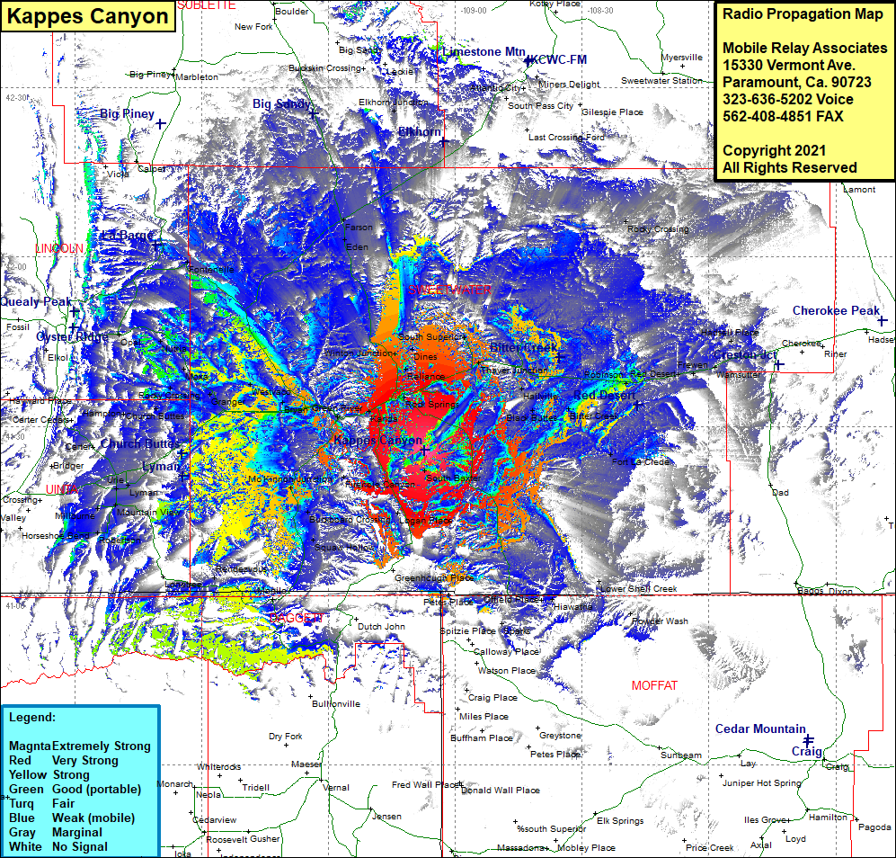 Kappes Canyon Coverage |
| Latitude: | 041 25 49.7N | 41.4304722 |
| Longitude: | 109 07 12.2W | -109.1200556 |
| Feet | Meters | |
| Ground Elevation: | 8,668.0 | 2,642.0 |
| HAAT: | 1,651.7 | 503.4 |
| City: | Quealy | |
| County: | Sweetwater | |
| State: | Wyoming |
This is not an MRA Owned Site. For space rental contact the site owner.
Do you own or manage this site? Click Here
Would you like to add a site to the Google Earth Map?? Click Here
Site Coverage: Coverage of Quealy, Blairtown, Rock Springs, North Baxter, Dines, Winton, South Supeior, Thayer Junction, Hallville, Black Buttes, Bitter Creek, Robinson, Tipton, Red Desert, Frewen, Wamsutter, Hadsell Place, Fort LaClede, South Baxter, Logan Place, Offield Place, Hiawatha, Petes Place, Squaw Hollow, Manila, Burntfork, Rendezvous, Robertson, Millburne, Mountain View, Fort Bridger, Lyman, Millersville, Antelope, Hampton, Church Buttes, Verne, Rocky Crossing, Opal, Nutria, Moxa, Granger, Westvaco Section, Bryan, Granger Jct, Peru, Riview, James Town, Green River, McKinnon Jct, Buckboard Crossing, Firehole Canon, Squaw Hollow, Stanbury Jct, Eden, Farson, Elkhorn Jct, South Pass City, Miners Delight