KYCN-AM
| Site Name: | KYCN-AM | 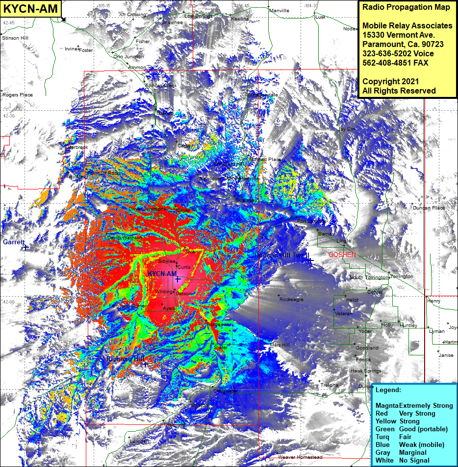 KYCN-AM Coverage |
| Latitude: | 042 02 44.6N | 42.0457222 |
| Longitude: | 104 56 48.4W | -104.9467778 |
| Feet | Meters | |
| Ground Elevation: | 4,796.0 | 1,461.8 |
| HAAT: | 298.2 | 90.9 |
| City: | Wheatland | |
| County: | Platte | |
| State: | Wyoming |
This is not an MRA Owned Site. For space rental contact the site owner.
Do you own or manage this site? Click Here
Would you like to add a site to the Google Earth Map?? Click Here
Site Coverage: Coverage of Sibylee, Curtis, Uva, Dwyer Junction, Dwyer, Cassa, Glendo, Elkhorn Creek, Wendover, Emigrant Hill, Hartville, Murhart Place, Meadowville, Jay Em, Guernsey, Fort Laramie, Barnes, Lingle, Torrington, Rockeagle, Heldt, Veteran, Yoder, Holly, Cottier, Huntley, Fonda, Goodland, Hawk Springs, Mers Hill, Whiting, Gibon, Ayers, Bordeaux, Slater, Chigwater, Brinton, Ferguson Corner, Diamond, Altus, Devils Washtub, Point of Rocks, Esterbrook, Binford