Laramie Prime
| Site Name: | Laramie Prime | 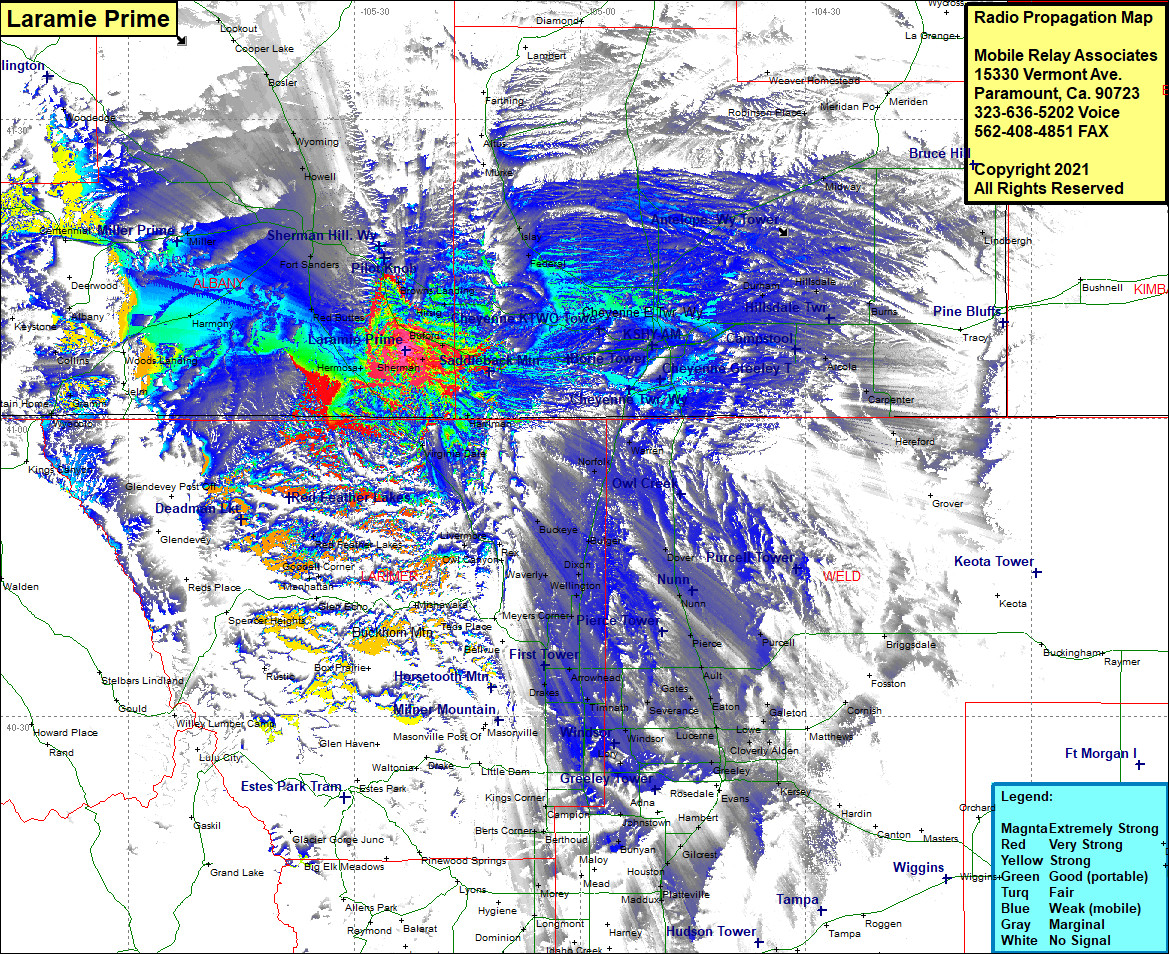 Laramie Prime Coverage |
| Latitude: | 041 06 48.6N | 41.1135000 |
| Longitude: | 105 23 15.4W | -105.3876111 |
| Feet | Meters | |
| Ground Elevation: | 8,226.0 | 2,507.3 |
| HAAT: | 410.9 | 125.2 |
| City: | Tie Siding | |
| County: | Albany | |
| State: | Wyoming |
This is not an MRA Owned Site. For space rental contact the site owner.
Do you own or manage this site? Click Here
Would you like to add a site to the Google Earth Map?? Click Here
Site Coverage: Coverage of Vedauwoo Glen, Hirsig, Browns Landing, Federal, Islay, Chigwater, Weaver Homestead, Robinson Place, Wilkinson Place, Durham, Archer, Cheyenne, Altvan, Orchard Valley, Athol, Gleason, Warren, Norfolk, Carr, Rockport, Buckeye, Borie, Granite Canon, Shellback, Silver Crown, Buford, Harriman, Virginia Dale, Livermore, Waverly, Dixon, Wellington, Dover, Nunn, Pierce, Purcell, Ault, Gates, Severance, Eaton, Galeton, Lowe, Alden, Lucerne, Greeley, Braewell, Kenyon Corner, Meyers Corner, Fort Collings, Drakes, Omega, Harmony, Timnath, Windsor, Bracewell, Gove, Lory, Livermore, Manhattan, Goodell Corner, Red Feather Lakes, Harmony, Tie Sidings, Hermosa, Red Buttes, Fort Sanders, Miller, Howell, Wyoming, Bosler, Lookout