Lyman
| Site Name: | Lyman | 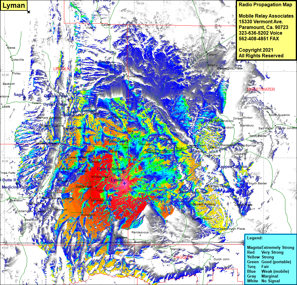 Lyman Coverage |
| Latitude: | 041 21 14.3N | 41.3539722 |
| Longitude: | 110 04 28.9W | -110.0746944 |
| Feet | Meters | |
| Ground Elevation: | 7,246.0 | 2,208.6 |
| HAAT: | 593.3 | 180.8 |
| City: | Lyman | |
| County: | Uinta | |
| State: | Wyoming |
This is not an MRA Owned Site. For space rental contact the site owner.
Do you own or manage this site? Click Here
Would you like to add a site to the Google Earth Map?? Click Here
Site Coverage: Coverage of Swetwater, Lincoln and Uinta Counties, Verna, Moxa, Fontenelle, Granger, Granger Junction, Westvaco, Bryan, Peru, Riovista, James Town, Green River, Kanda, Blairtown, Rock Springs, Dines, Winton, Squaw Hollow, Buckboard Crossing, McKinnon Junction, Millersville, Lyman, Mountain View, Millburne, Robertson, Fort Bridger, Carter, Elkhurst, Hampton, Church Buttes, Carter Cedars, Carter, Horseshoe Bend, Bagen, Byrnes Crossing, Bridger, Elkol, Glencoe Junction, Opal, Nutria, Rocky Crossing