Miller Prime
| Site Name: | Miller Prime | 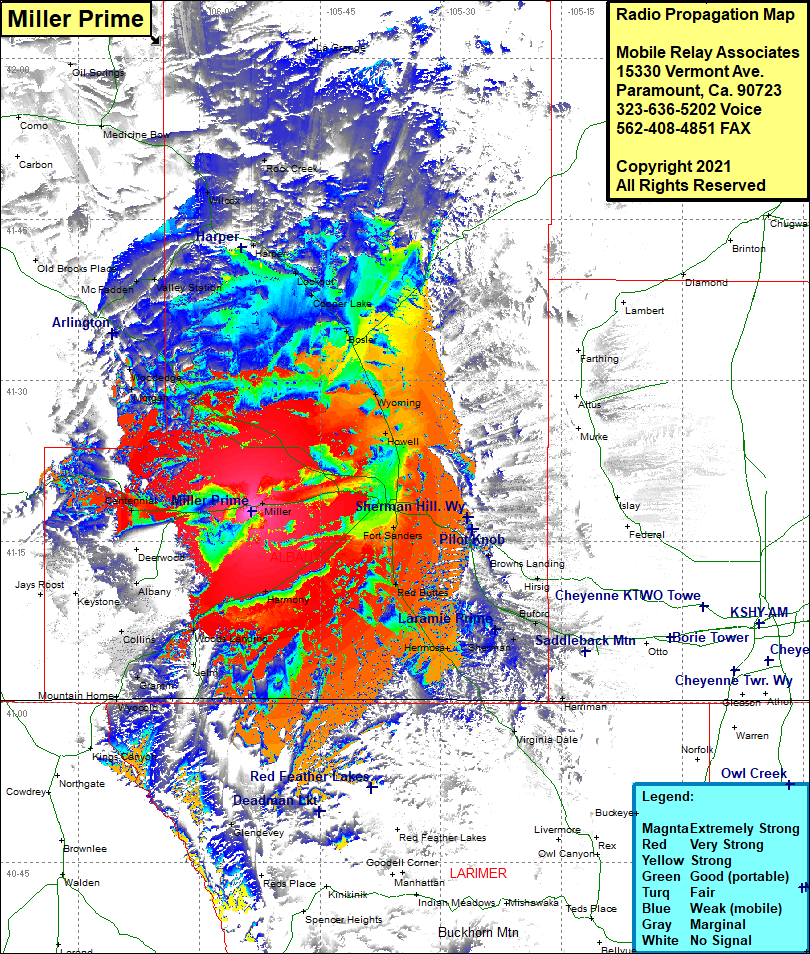 Miller Prime Coverage |
| Latitude: | 041 17 45.7N | 41.2960278 |
| Longitude: | 105 53 31.8W | -105.8921667 |
| Feet | Meters | |
| Ground Elevation: | 7,714.0 | 2,351.2 |
| HAAT: | 421.2 | 128.4 |
| City: | Miller | |
| County: | Albany | |
| State: | Wyoming |
This is not an MRA Owned Site. For space rental contact the site owner.
Do you own or manage this site? Click Here
Would you like to add a site to the Google Earth Map?? Click Here
Site Coverage: Coverage of Miller, Laramie, Fort Sanders, Browns Landing, Hirsig, Vedauwoo Glen, Hermosa, Tie Siding, Red Buttes, Fort Sanders, Harmony, Woods Landing, New Jelm, Jelm, Glendevey, Foxpark, Collins, Albany, Centennial, Mountain Home, Morgan, Wooddedge, McFadden, Valley Station, WIlcox, Rock River, Rock Creek, Harper, Lookout, Cooper Lake, Bosler, Wyoming, Howell