Oyster Ridge
| Site Name: | Oyster Ridge | 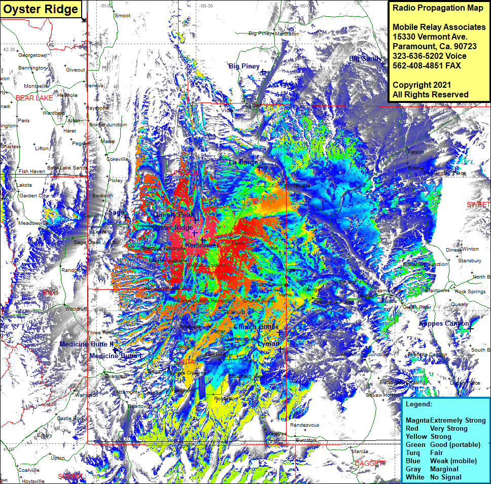 Oyster Ridge Coverage |
| Latitude: | 041 47 26.2N | 41.7906111 |
| Longitude: | 110 30 30.2W | -110.5083889 |
| Feet | Meters | |
| Ground Elevation: | 7,857.0 | 2,394.8 |
| HAAT: | 882.8 | 269.1 |
| City: | Kemmerer | |
| County: | Lincoln | |
| State: | Wyoming |
This is not an MRA Owned Site. For space rental contact the site owner.
Do you own or manage this site? Click Here
Would you like to add a site to the Google Earth Map?? Click Here
Site Coverage: Coverage of Viola, Calpet, Big Piney, Marbleton, Fontenelle, Farson, Eden, Washington Place, Green River, Riview, James Town, Bryan, Westvaco, Granger Jct, Granger, Moxa, Nutria, Opal, Rocky Crossing, Church Buttes, Hampton, Carter Cedars, Antelope, Carter, Bridger, Fort Bridger, Millerville, Lyman, Mountain View, Robertson, Lonetree, Piedmont, Brynes Crossing, Bagan, Aspen, Altamont, Beartwon, Evanston, Wahsatch, Woodruff, Randolph, Sage Creek Jct, Leefe, Carlson, Beckwith