Pilot Knob
| Site Name: | Pilot Knob | 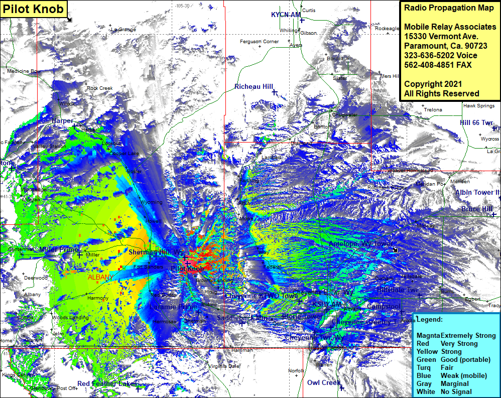 Pilot Knob Coverage |
| Latitude: | 041 16 06.0N | 41.2683333 |
| Longitude: | 105 26 02.4W | -105.4340000 |
| Feet | Meters | |
| Ground Elevation: | 8,782.0 | 2,676.8 |
| HAAT: | 927.0 | 282.6 |
| City: | Laramie | |
| County: | Albany | |
| State: | Wyoming |
This is not an MRA Owned Site. For space rental contact the site owner.
Do you own or manage this site? Click Here
Would you like to add a site to the Google Earth Map?? Click Here
Site Coverage: Coverage of Murke, Altus, Farthing, Lambert, Diamond, Brinton, Chugwater, Islay, Federal, Weaver Homestead, Robinson Place, Meriden, Midway, Durham, Hillsdale, Burns, Egbed, Arcola, Carpenter, Hereford, Gleason, Warren, Cheyenne, Altvan, Federal, Harriman, Virginia Dale, Otto, Borie, Hirsig, Browns Landing, Red Buttes, Hermosa, Fort Sanders, Harmony, Gramm, Wyocolo, Collins, Miller, Centennial, Morgan, Woodedge, McFadden, Valley Station, Wilcox, Rock Creek, Harper, Lookouot, Cooper Lake, Bosler, Wyoming, Howell