Rattlesnake Ridge
| Site Name: | Rattlesnake Ridge | 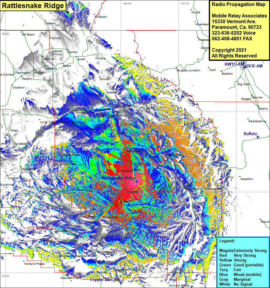 Rattlesnake Ridge Coverage |
| Latitude: | 044 03 58.5N | 44.0662500 |
| Longitude: | 107 51 51.6W | -107.8643333 |
| Feet | Meters | |
| Ground Elevation: | 4,683.0 | 1,427.4 |
| HAAT: | 479.6 | 146.2 |
| City: | Worland | |
| County: | Washakie | |
| State: | Wyoming |
This is not an MRA Owned Site. For space rental contact the site owner.
Do you own or manage this site? Click Here
Would you like to add a site to the Google Earth Map?? Click Here
Site Coverage: Coverage of Durkee, Eccles, Rairden, Manderson, Basin, Flitners Corner, Shell, Hyattville, Stucco, Ten Sleep, Williams Mill, French Vee, Worland, Colter, Winchester, Gebo, Kirby, Lucerne, Red Lane, Thermopolis, Minnesela, Nickelson Place, Domick, Duncan Homestead, Embar, Grass Creek, Sales Place, Hewitt Place, Fenton, Emblem, Burlington, Otto