Richeau Hill
| Site Name: | Richeau Hill | 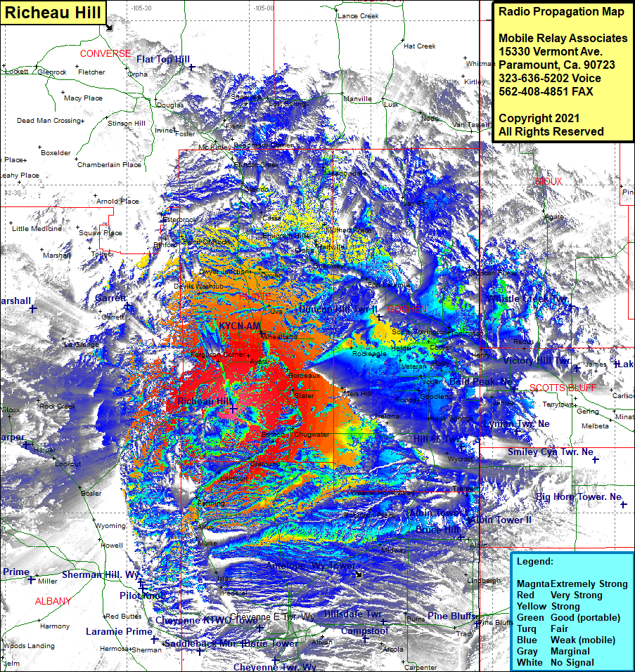 Richeau Hill Coverage |
| Latitude: | 041 49 00.5N | 41.8168056 |
| Longitude: | 105 03 50.1W | -105.0639167 |
| Feet | Meters | |
| Ground Elevation: | 6,812.0 | 2,076.3 |
| HAAT: | 1,159.3 | 353.3 |
| City: | Wheatland | |
| County: | Platte | |
| State: | Wyoming |
This is not an MRA Owned Site. For space rental contact the site owner.
Do you own or manage this site? Click Here
Would you like to add a site to the Google Earth Map?? Click Here
Site Coverage: Coverage of Ferguson Corner, Ayers, Wheatland, Uva, Dwyer, Dwyer Jct, Cassa, Glendo, Elkhorn Creek, Bona, Orin Juction, Fisher, Shawnee, Lost Springs, Manville, Meadowdale, Muthart Place, Hartville, Crane, Emigrant Hills, Guernsey, Fort Laramie, Jee Em, Lusk, Duncan Place, Roach, Redus, Henry, Janise, Holly, Cottier, Torrington, South Torrington, Rockeagle, Veteran, Heldt, Yoder, Wycross, Tremain, Weaver Homestead, Robinson Place, Midway, Pine Bluffs, Tracy, Lindbergh, Albin, Burns, Durham, Arcola, Carpenter, Cheyenne, Federal, Islay, Murke, Altus, Farthing, Lambert, Diamond, Brinton, Chugwater, Slater, Bordeaux, Bosler, Lookout, Harper, Wilcox, Rock Creek, LaGrange, Garrett, Devils Washtub