Sage
| Site Name: | Sage | 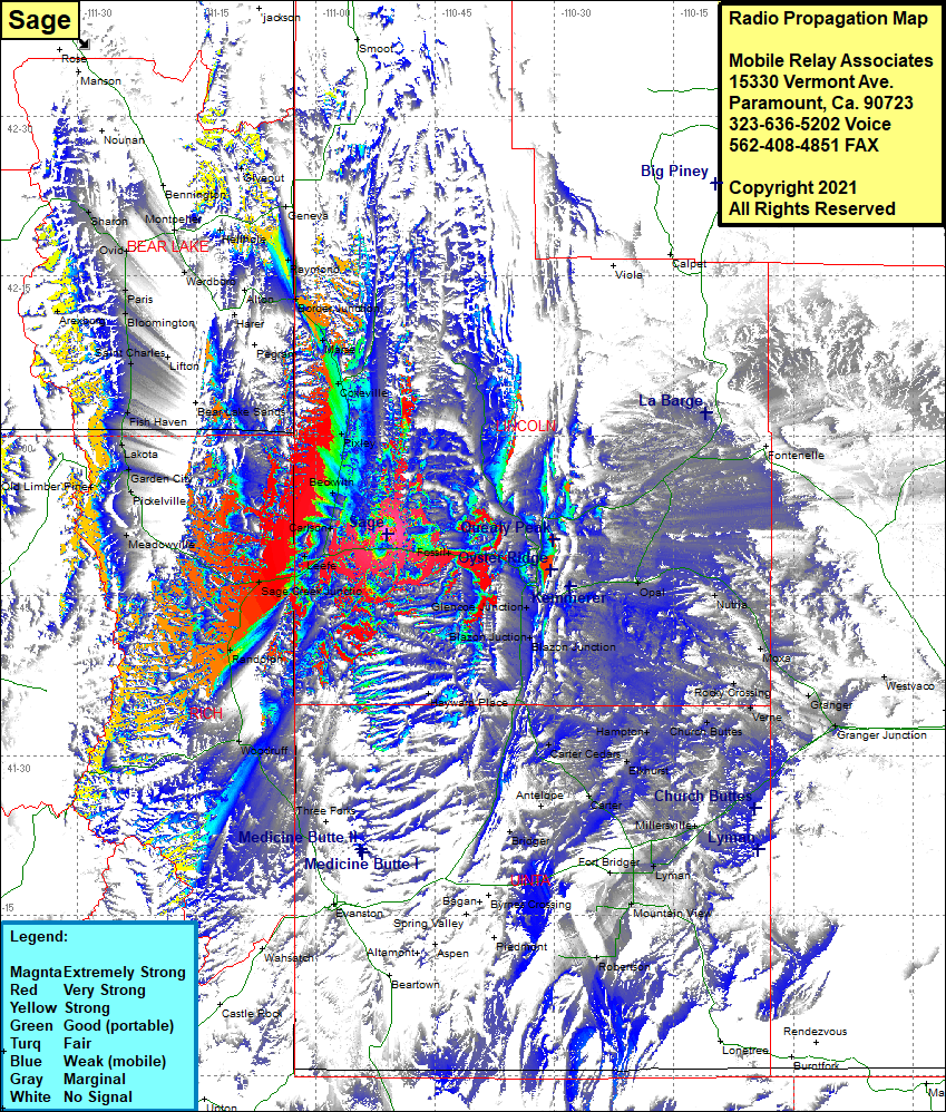 Sage Coverage |
| Latitude: | 041 50 50.2N | 41.8472778 |
| Longitude: | 110 51 04.3W | -110.8511944 |
| Feet | Meters | |
| Ground Elevation: | 7,671.0 | 2,338.1 |
| HAAT: | 738.5 | 225.1 |
| City: | Sage | |
| County: | Lincoln | |
| State: | Wyoming |
This is not an MRA Owned Site. For space rental contact the site owner.
Do you own or manage this site? Click Here
Would you like to add a site to the Google Earth Map?? Click Here
Site Coverage: Coverage of Viola, Calpet, Fontenelle, Opal, Nutria, Moxa, Granger, Granger Jct, Westvaco, Rocky Crossing, Verne, Church Buttes, Hampton, Elkhurst, Carter Cedars, Carter, Antelope, Bridger, Lyman, Millersville, Mountain View, Millburne, Howard Place, Blazon Jct, Glencoe Jct, Woodruff, Randolph, Sage Creek Jct, Leefe, Sage, Carlson, Beckwith, Pixley, Cokeville, Marse, Border Jct, Border, Raymond, Meadowville, Pickelville, Garden City, Lakota, Fish Haven, Saint Charles, Bloomington, Paris, Wardboro, Hellhole, Geneva, Giveout, Raymond