Black Peak
| Site Name: | Black Peak | 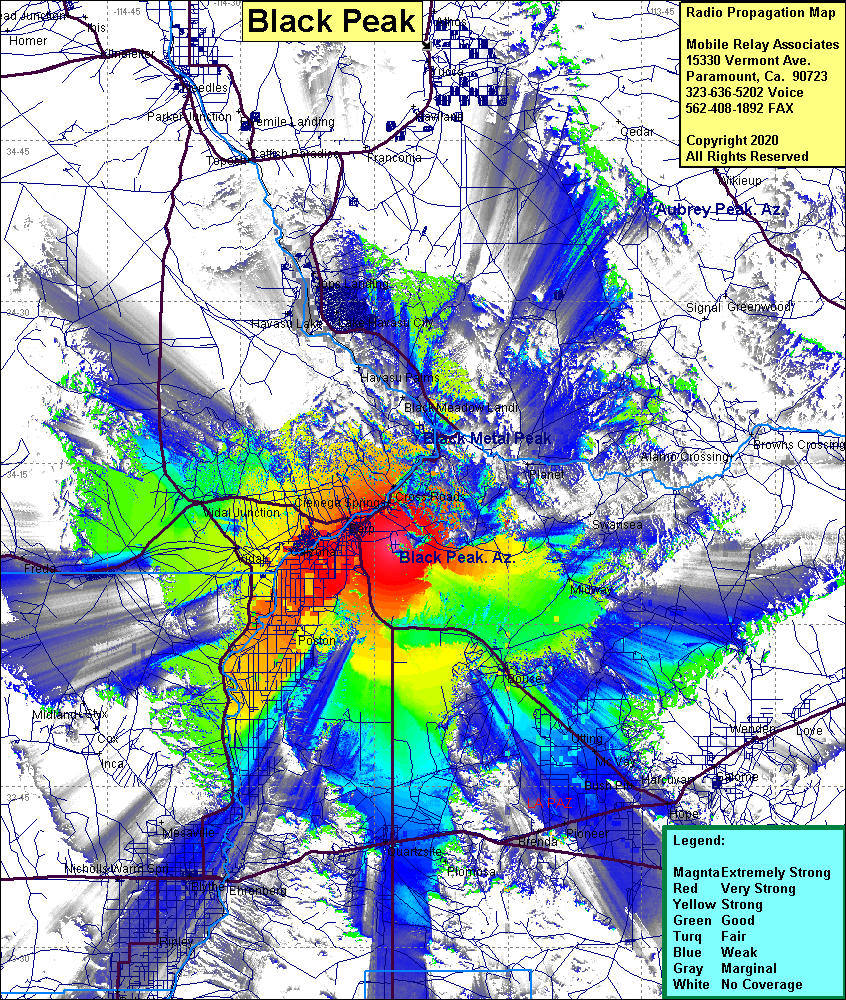 Black Peak Coverage |
| Latitude: | 034 07 28.8N | 34.1246667 |
| Longitude: | 114 12 42.2W | -114.2117222 |
| Feet | Meters | |
| Ground Elevation: | 1627.0 | 495.9 |
| HAAT: | 974.1 | 296.9 |
| City: | Parker | |
| County: | La Paz | |
| State: | Arizona |
This is not an MRA Owned Site. For space rental contact the site owner.
Do you own or manage this site? Click Here
Would you like to add a site to the Google Earth Map?? Click Here
Site Coverage: Coverage of Poston, Vidal, Vidal Junction, Earp, Parker, Cienega Springs, Cross Roads, Parker Dam, Bouse, Utting, Midway, Rice, Blythe, Ehrenberg, Quartsite, Mc Vay, Bush Pit, Desert Wells, Pioneer, Plomosa