Mt Elden
| Site Name: | Mt Elden |  Mt Elden Coverage |
| Latitude: | 035 14 27.0N | 35.2408333 |
| Longitude: | 111 35 52.0W | -111.5977778 |
| Feet | Meters | |
| Ground Elevation: | 9292.0 | 2,832.2 |
| HAAT: | 1827.3 | 557.0 |
| City: | Flagstaff | |
| County: | Coconino | |
| State: | Arizona |
This is not an MRA Owned Site. For space rental contact the site owner.
Do you own or manage this site? Click Here
Would you like to add a site to the Google Earth Map?? Click Here
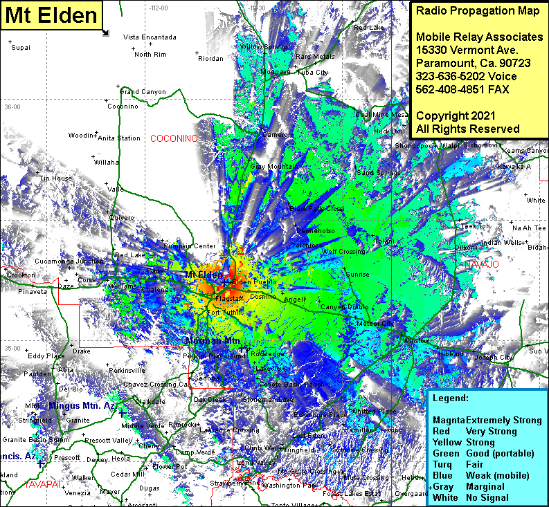
Site Coverage: Coverage of Flagstaff, Cogdill Center, Elden Pueblo, Fort Tuthill, Mountainaire, Angell, Canyon Diablo, Two Guns, Meteor City, West Winslow, Winslow, Hibbard, Joseph City, Holbrook, Whitted Place, Hamilton Crossing, Macks Crossing, Wiggins Crossing, Jones Crossing, Horse Crossing, Lost Eden, Long Valley, Camp Verde, Stoneman Lake, Coyote Basin Ranch, Lakeview, Rockledge, Pilgrim Playground, Tempe Camp, Bellemont, Parks, Pine Tank, Williams, Serento, Quivero, Gray Mountain, Cameron, Willow Springs, Moenave, Rare Metals, Pi Va Hon Kia Pi, Tolani, Ma Shon Pi, Polacca, Wepo Village, Tees Toh, Cedar Springs, Wolf Crossing, Dennehotso, Black Falls Crossing
