Arapahoe Basin
| Site Name: | Arapahoe Basin | 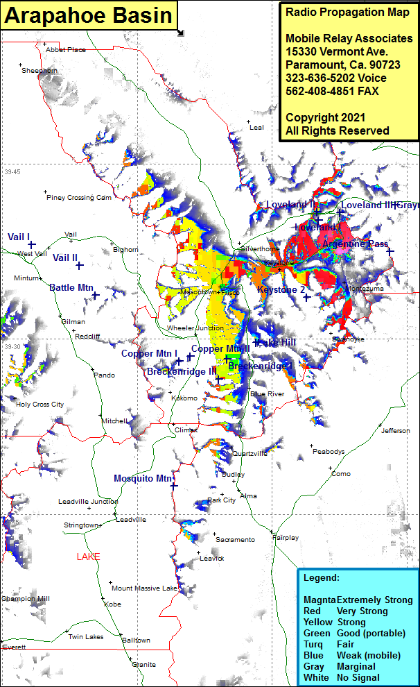 Arapahoe Basin Coverage |
| Latitude: | 039 37 30.1N | 39.6250278 |
| Longitude: | 105 52 30.6W | -105.8751667 |
| Feet | Meters | |
| Ground Elevation: | 12489.0 | 3806.6 |
| HAAT: | 1236.7 | 376.9 |
| City: | Keystone | |
| County: | Summit | |
| State: | Colorado |
This is not an MRA Owned Site. For space rental contact the site owner.
Do you own or manage this site? Click Here
Would you like to add a site to the Google Earth Map?? Click Here
Site Coverage: Coverage of Keystone, Masontown, Saint John, Montezuma, Frisco, US Highway 6 from south of Dillon to Loveland