Iron Mountain
| Site Name: | Iron Mountain | 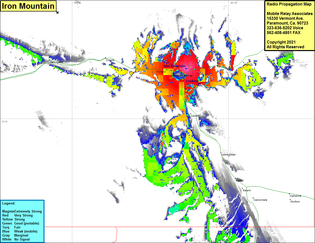 Iron Mountain Coverage |
| Latitude: | 039 33 43.2N | 39.5620000 |
| Longitude: | 107 19 03.2W | -107.3175556 |
| Feet | Meters | |
| Ground Elevation: | 7257.0 | 2211.9 |
| HAAT: | -618.2 | -188.4 |
| City: | Glenwood Springs | |
| County: | Garfield | |
| State: | Colorado |
This is not an MRA Owned Site. For space rental contact the site owner.
Do you own or manage this site? Click Here
Would you like to add a site to the Google Earth Map?? Click Here
Site Coverage: Coverage of Glenwood Springs, Cardiff, Cattle Creek, Kiggin, Funston, portions of Interstate I70 / US Highway 6 in the Glenwood Springs area