Keystone 2
| Site Name: | Keystone 2 | 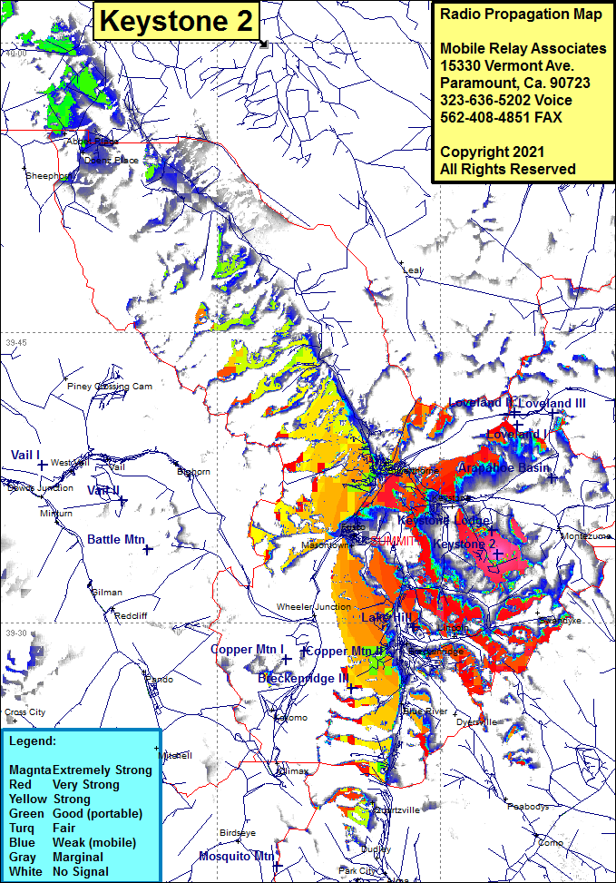 Keystone 2 Coverage |
| Latitude: | 039 33 33.7N | 39.5593611 |
| Longitude: | 105 56 09.1W | -105.9358611 |
| Feet | Meters | |
| Ground Elevation: | 11653.0 | 3551.8 |
| HAAT: | 860.6 | 262.3 |
| City: | Silverthorne | |
| County: | Summit | |
| State: | Colorado |
This is not an MRA Owned Site. For space rental contact the site owner.
Do you own or manage this site? Click Here
Would you like to add a site to the Google Earth Map?? Click Here
Site Coverage: Coverage of Silverthorne, Keystone, Frisco, Masontown, portions of Interstate I70 / US Highway 6 in the Keystone area