Loveland IV
| Site Name: | Loveland IV | 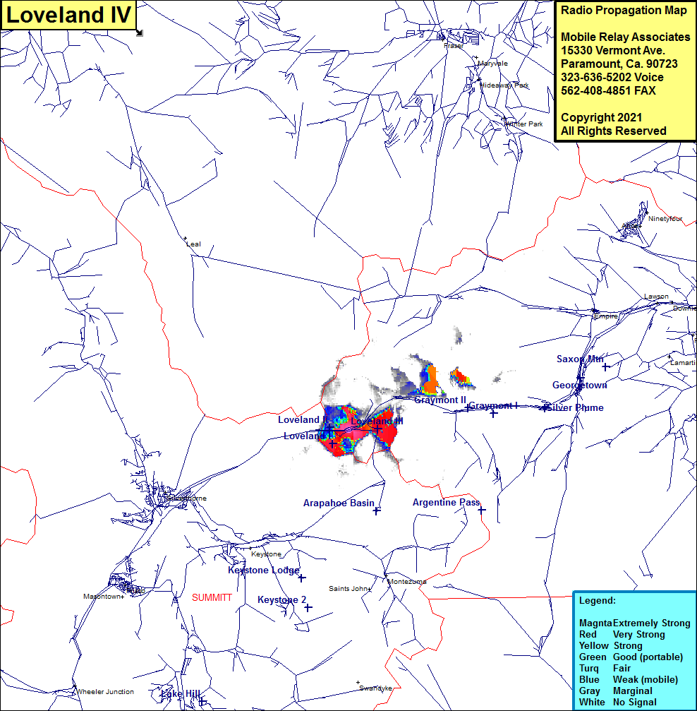 Loveland IV Coverage |
| Latitude: | 039 40 47.9N | 39.6799722 |
| Longitude: | 105 53 58.7W | -105.8996389 |
| Feet | Meters | |
| Ground Elevation: | 10952.0 | 3338.2 |
| HAAT: | -220.7 | -67.3 |
| City: | Graymont | |
| County: | Clear Creek | |
| State: | Colorado |
This is not an MRA Owned Site. For space rental contact the site owner.
Do you own or manage this site? Click Here
Would you like to add a site to the Google Earth Map?? Click Here
Site Coverage: Coverage of Loveland Ski Area and Interstate I70 east from the continental divide at the Eisenhower tunnel to just beyone Herman Gulch Road plus portions of US Highway 6 in the Loveland area