Brasstown Bald
| Site Name: | Brasstown Bald | 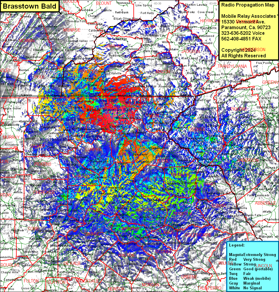 Brasstown Bald Coverage |
| Latitude: | 034 52 28.1N | 34.8744722 |
| Longitude: | 083 48 38.9W | -83.8108056 |
| Feet | Meters | |
| Ground Elevation: | 4780.0 | 1456.9 |
| HAAT: | 2334.2 | 711.5 |
| City: | Macedonia | |
| County: | Towns | |
| State: | Georgia |
This is not an MRA Owned Site. For space rental contact the site owner.
Do you own or manage this site? Click Here
Would you like to add a site to the Google Earth Map?? Click Here
Site Coverage: Coverage of Towns, Union, Hall, Banks, Franklin, Jackson and Forsyth Counties, most of Dawson, Clay (NC), CHerokee (NC), Lumpkin, Fannin, Gilmer, Pickens, Cherokee, Gwinnett, Barrow, Clarke, Oglethorpe, Hart and Elbert Counties, some of Wilkes, Lincoln, Taliaferro, Gree, Morgan, Newton, Rockdale, Henry, Clayton, Fulton, Douglas, Paulding, Cobb, Pickens, Gordon, Bartow, Floyd, Polk, Chattooga, Walker, Catoosa, Whitfield, Murray, Macon (NC), Jackson (NC), Haywood (NC), Transylvania (NC), Henderson (NC), Marion (TN), Sequatchie (TN), Hamilton (TN), Rhea (TN), Bledsoe (TN), Marion (TN), CUmberland (TN), Morgan (TN), Anderson (TN), Roane (TN), Polk (TN), Monroe (TN), Graham (TN), Swain (TN), Sevier (TN), Blount (TN), Knox (TN) and Loudon (TN) Counties