Dug Gap
| Site Name: | Dug Gap | 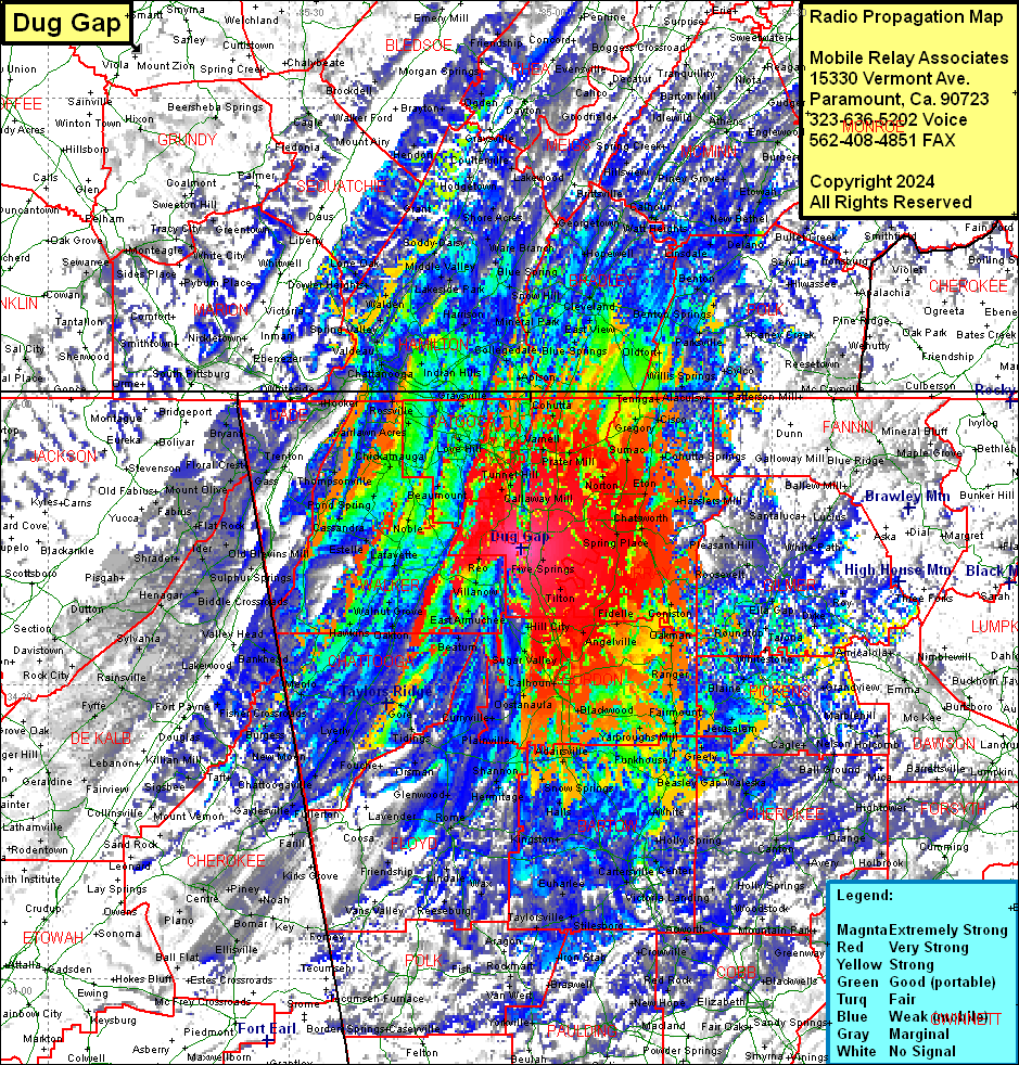 Dug Gap Coverage |
| Latitude: | 034 43 59.5N | 34.7331944 |
| Longitude: | 085 01 07.4W | -85.0187222 |
| Feet | Meters | |
| Ground Elevation: | 1822.0 | 555.3 |
| HAAT: | 987.3 | 300.9 |
| City: | Phelps | |
| County: | Whitfield | |
| State: | Georgia |
This is not an MRA Owned Site. For space rental contact the site owner.
Do you own or manage this site? Click Here
Would you like to add a site to the Google Earth Map?? Click Here
Site Coverage: Coverage of Whitfield, Murray and Catoosa Counties, most of Walker, Chattooga, Murray, Gordon, Gilmer, Pickens, Cherokee, Bartow, Floyd, Bradley (TN) and Hamilton (TN) Counties, some of McMinn (TN), Monroe (TN),Blount (TN), Loudon (TN), Roane (TN), Cumberland (TN), White (TN), Van Buren (TN), Grundy (TN), Franklin (TN), Marion (TN), Sequatchie (TN), Bledsoe (TN), Polk (TN), Meigs (TN), Rhea (TN), Bledsoe (TN), Sequatchie (TN), Marion (TN), Gundy (TN), Warren (TN), Franklin (TN), Van Buren (TN), Cherokee (NC), Clay (NC), Graham (NC), Towns, Union, Lumpkin, Hall, Gwinnett, deKalb, Fulton, Douglas, Haralson, Cleburne (AL), Calhoun (AL), etowah (AL), Cherokee (AL), Marshall (AL), Jackson (AL) and DeKalb (AL) Counties